
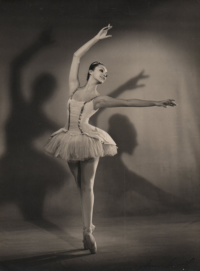
Dispuestos a acompañarlo en sus búsquedas y motivaciones, organizamos ocho Subastas Online al año, seleccionando obras originales, raras, curiosas y especiales; todas coleccionables. Luego de minuciosos estudios pasan a formar parte de cada nuevo catálogo en la expectativa de seguir su rumbo hacia otros destinos. Coleccionar es un arte y una pasión. Conozca más haciendo click aquí
SUBASTAS ONLINE
Subasta Online XXXI
LA VOZ DE LOS EXPERTOS
Le ofrecemos aquí la opinión de expertos nacionales e internacionales. Nos iluminan el camino del coleccionismo ofreciéndonos sus conocimientos y experiencias.
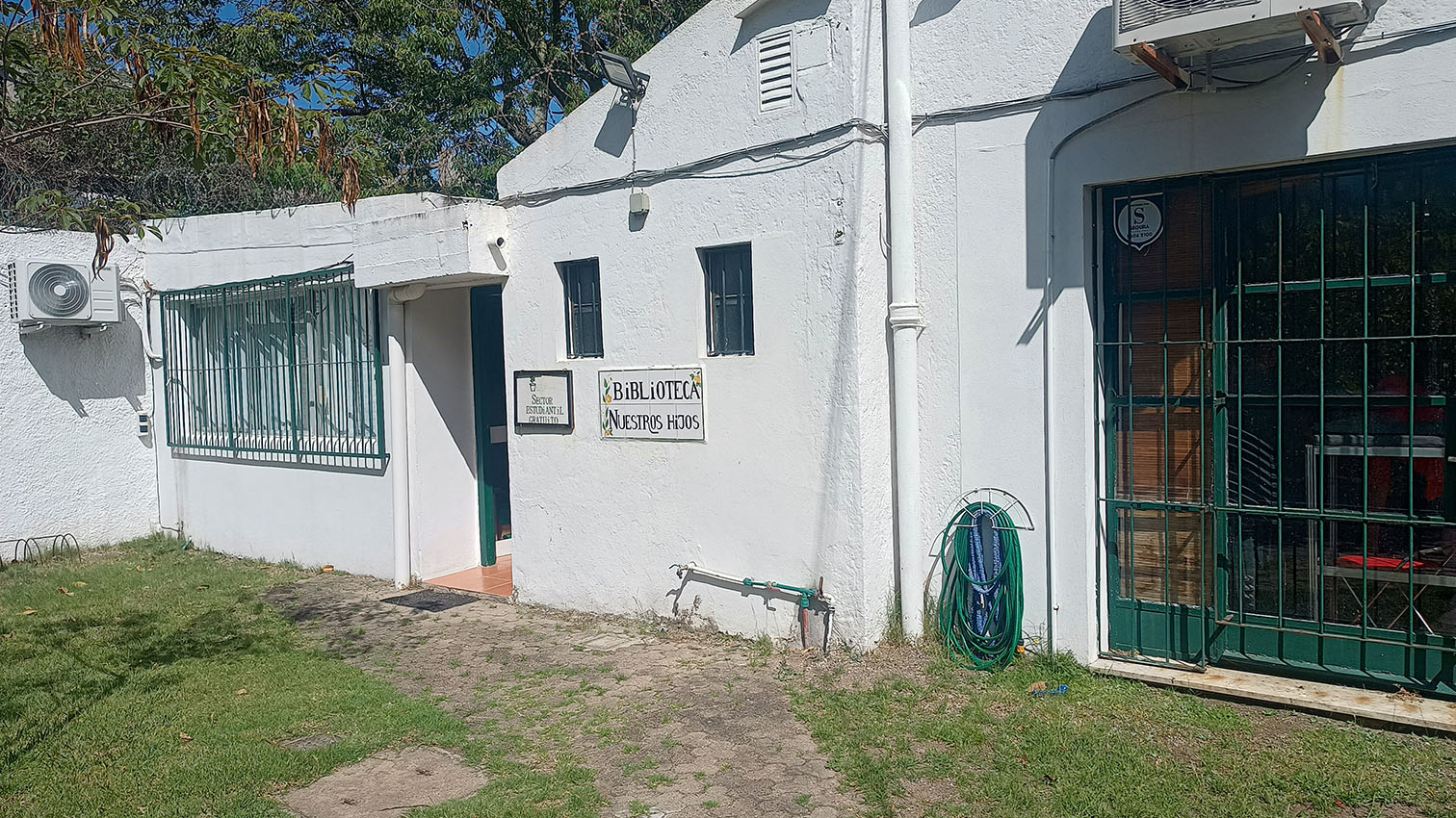
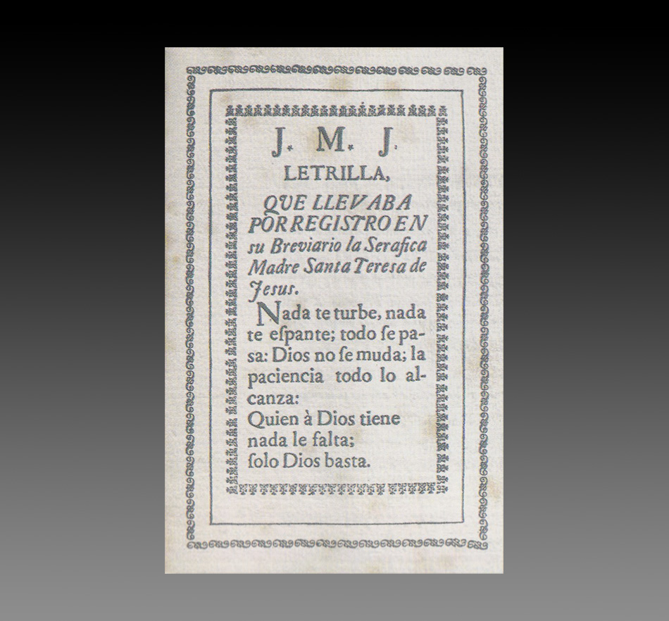
Carlos Sordo López, historias y misterios de un enorme platero
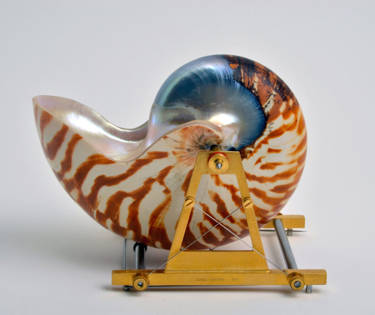
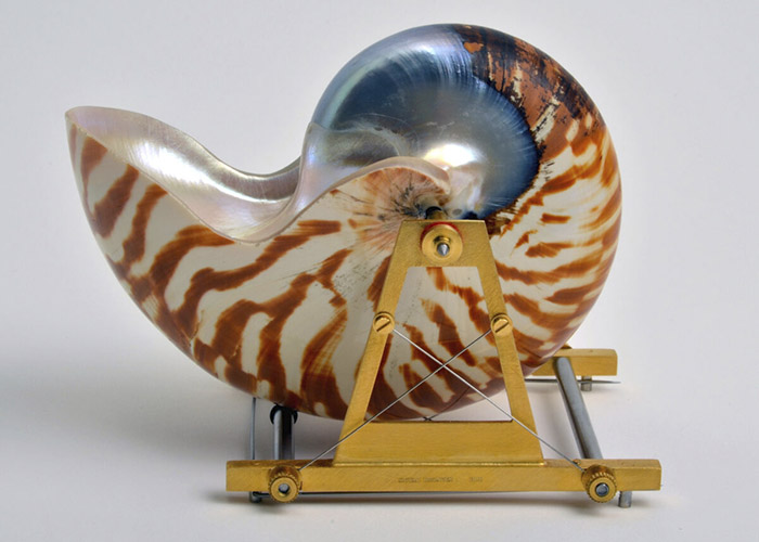
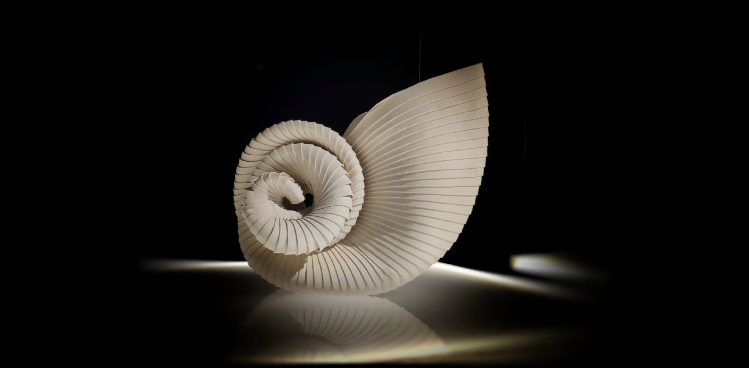
Un huevo colgante y un nautilo para llevar
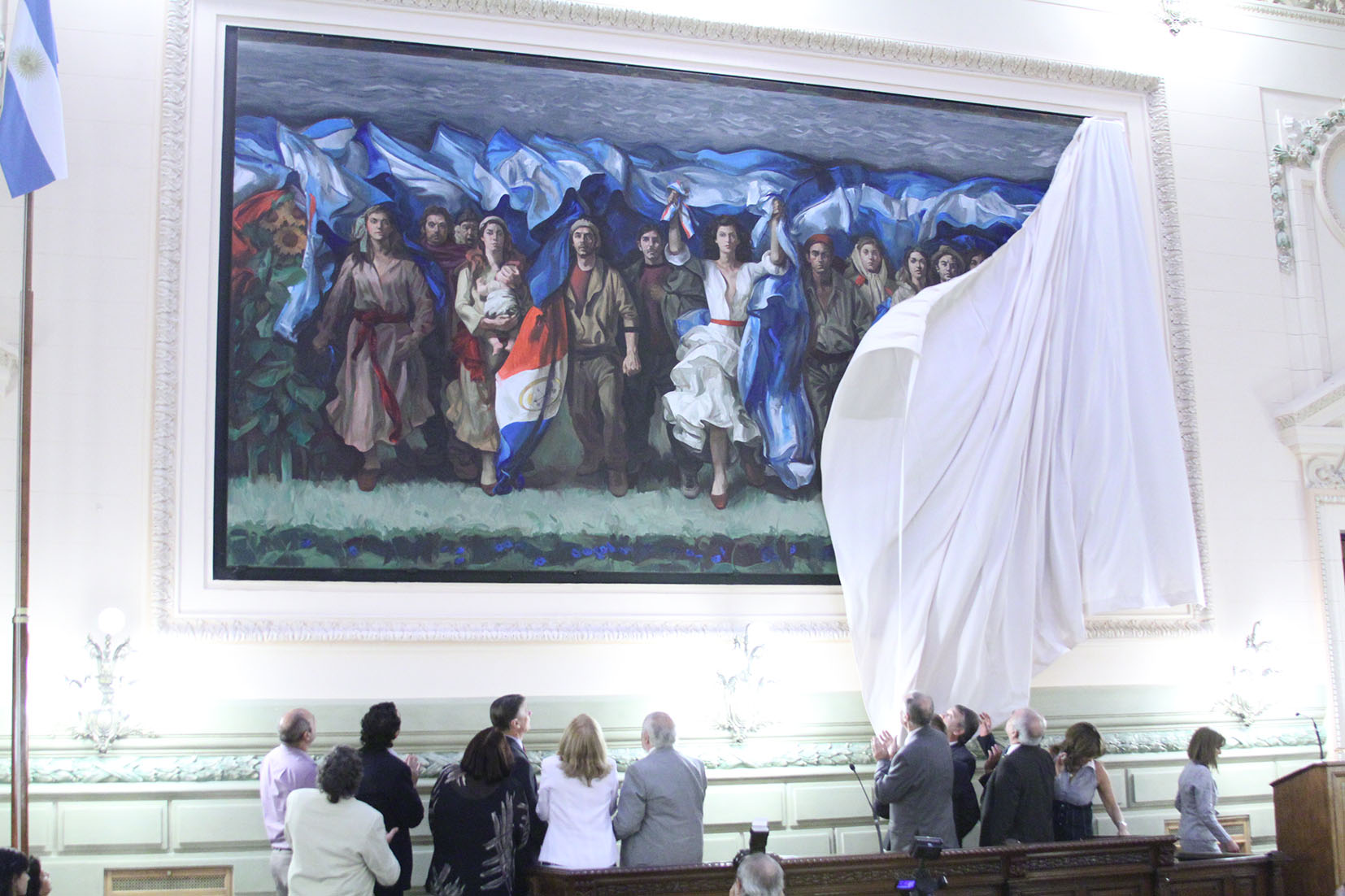
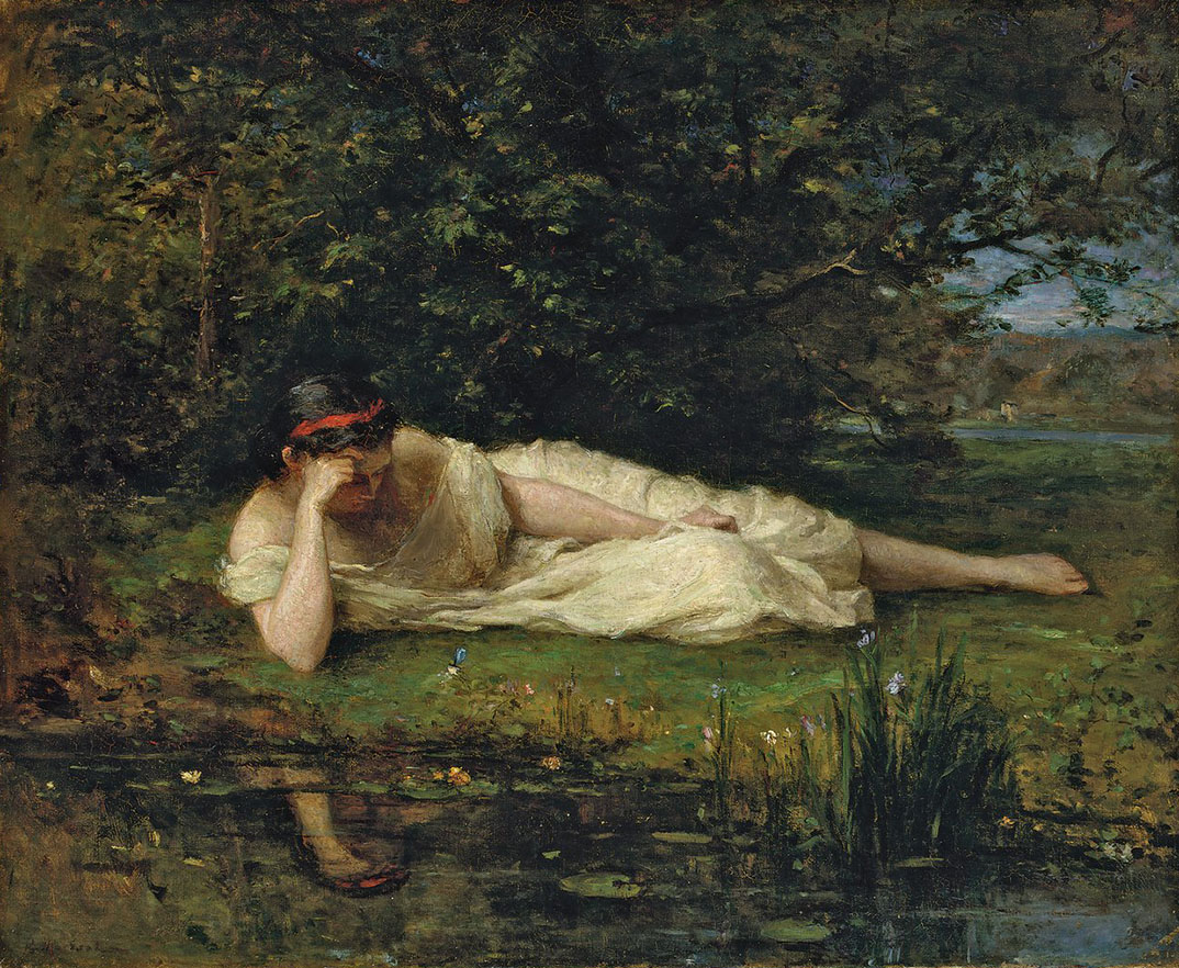
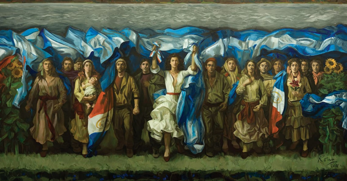
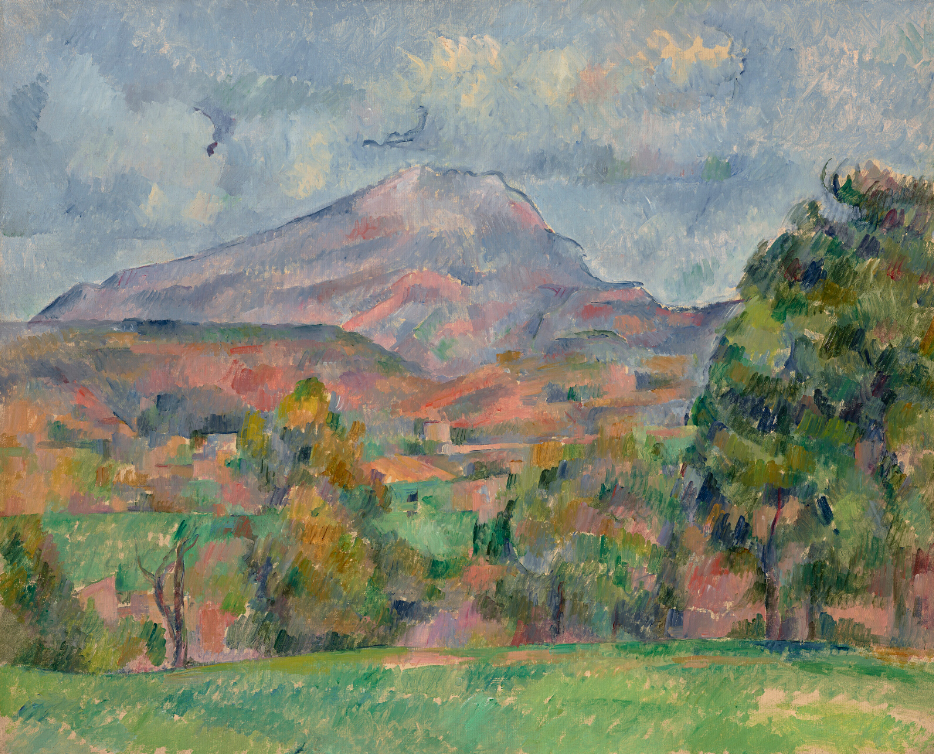
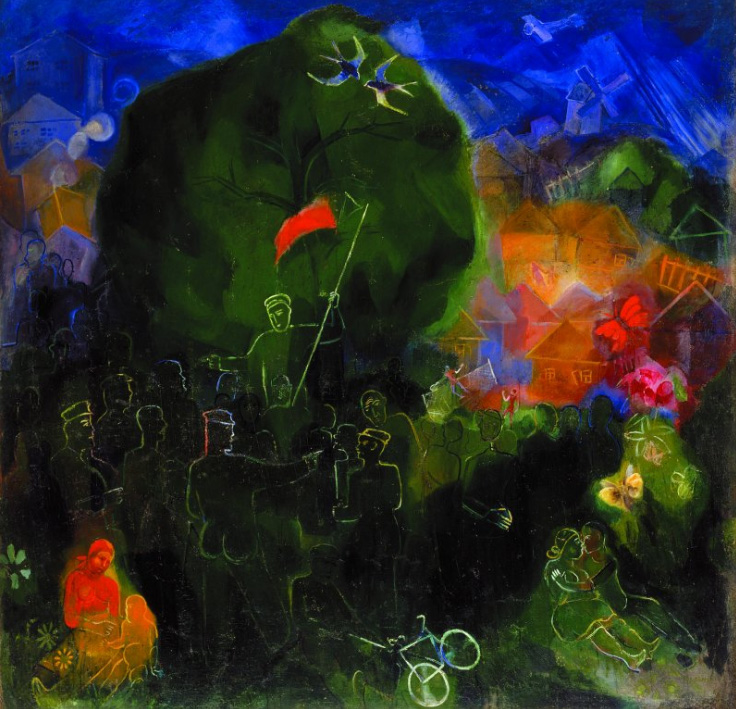
Guillermo Roux y La Constitución guiando al pueblo
La belleza interior de Berthe Morisot
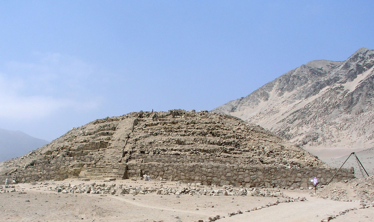
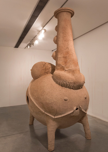
Civilización Caral, la joya más antigua de América
Te conozco mascarita
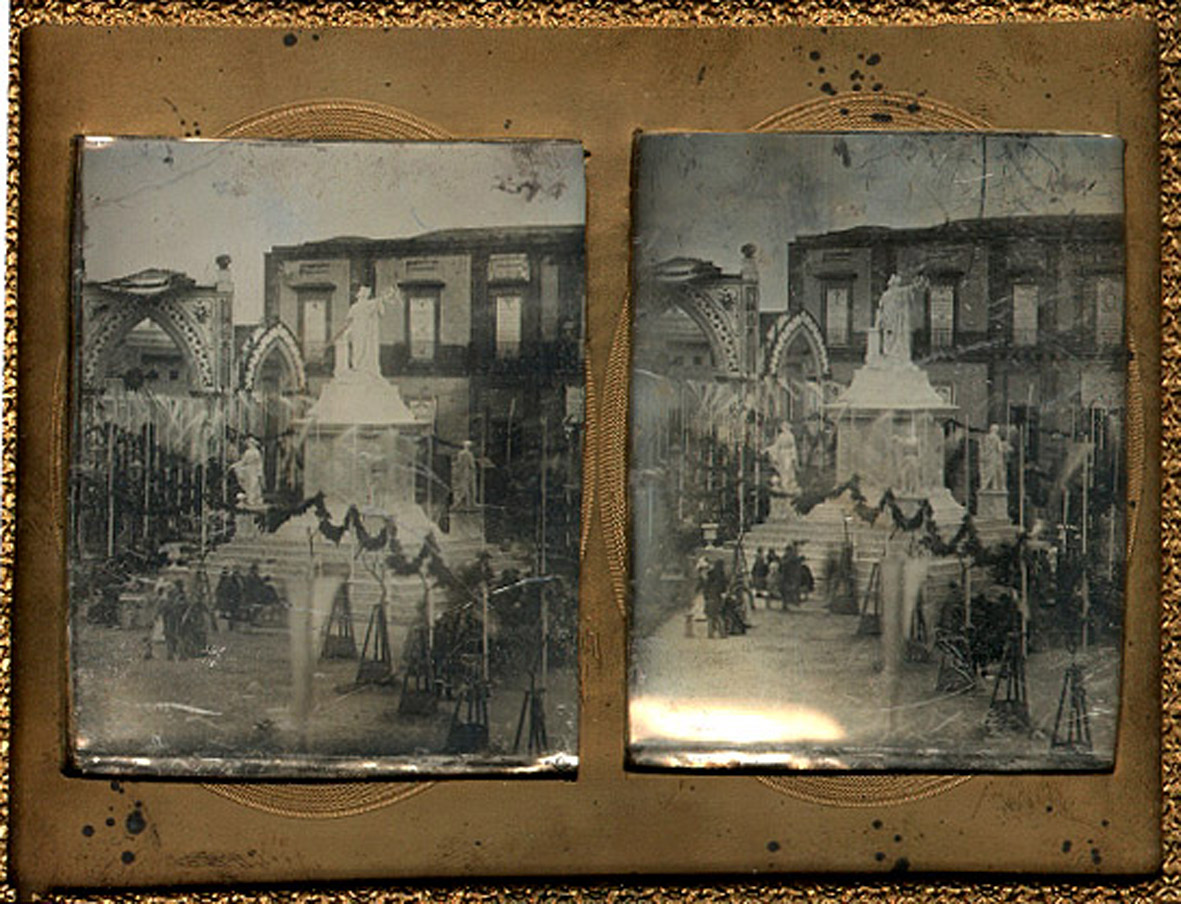
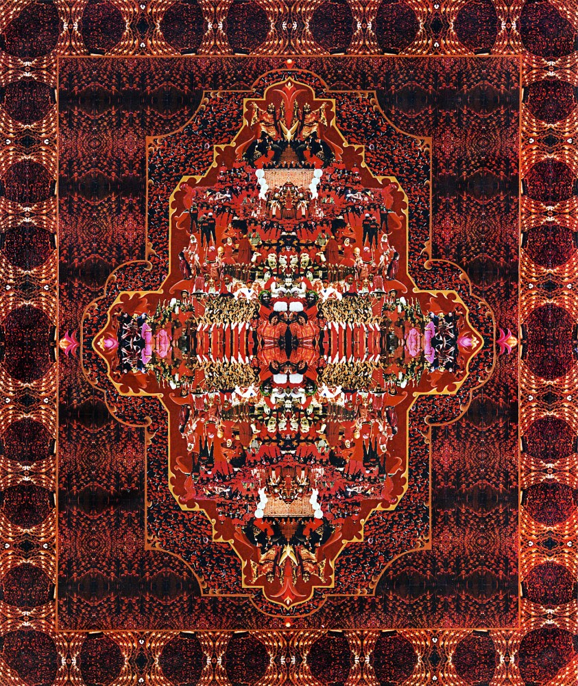
Argentina a través de la sorprendente tercera dimensión
La película La Sociedad de la Nieve visibilizó a quienes no volvieron de la cordillera en el milagro de Los Andes
El museo, una creación compartida, en la voz de Luis Camnitzer
Guillermo Roux, un renacentista contemporáneo
La libertad de coleccionar
La donación de bienes culturales y la fortaleza de un país por Sebastián Hidalgo Sola *
Cuando admirar no es suficiente
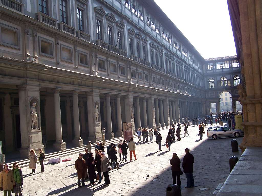
Florencia no es sólo renacimiento.

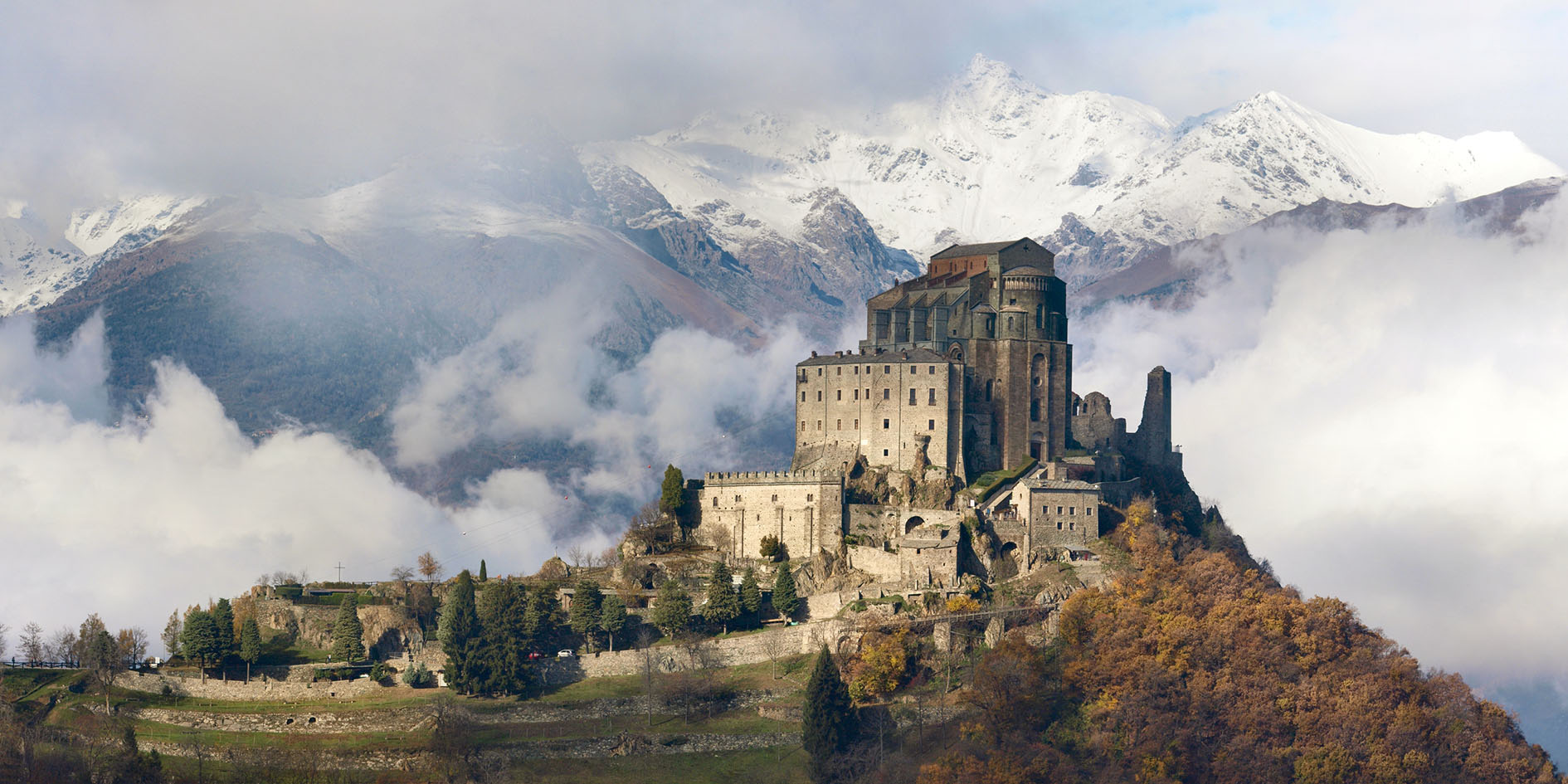
Encuentro en Turín con los dinosaurios de Ezio Gribaudo (1929-2022)
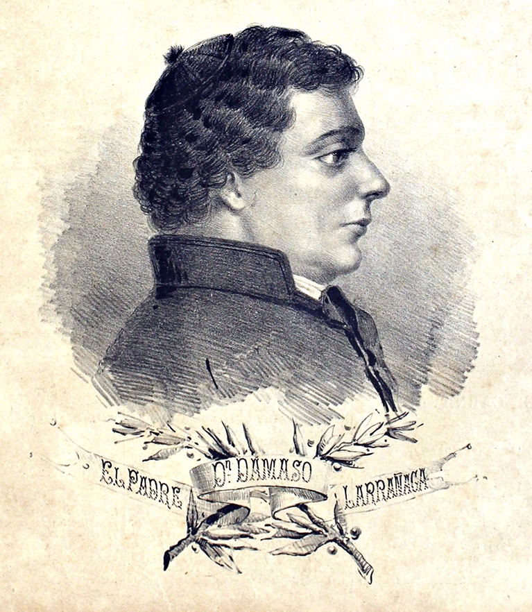
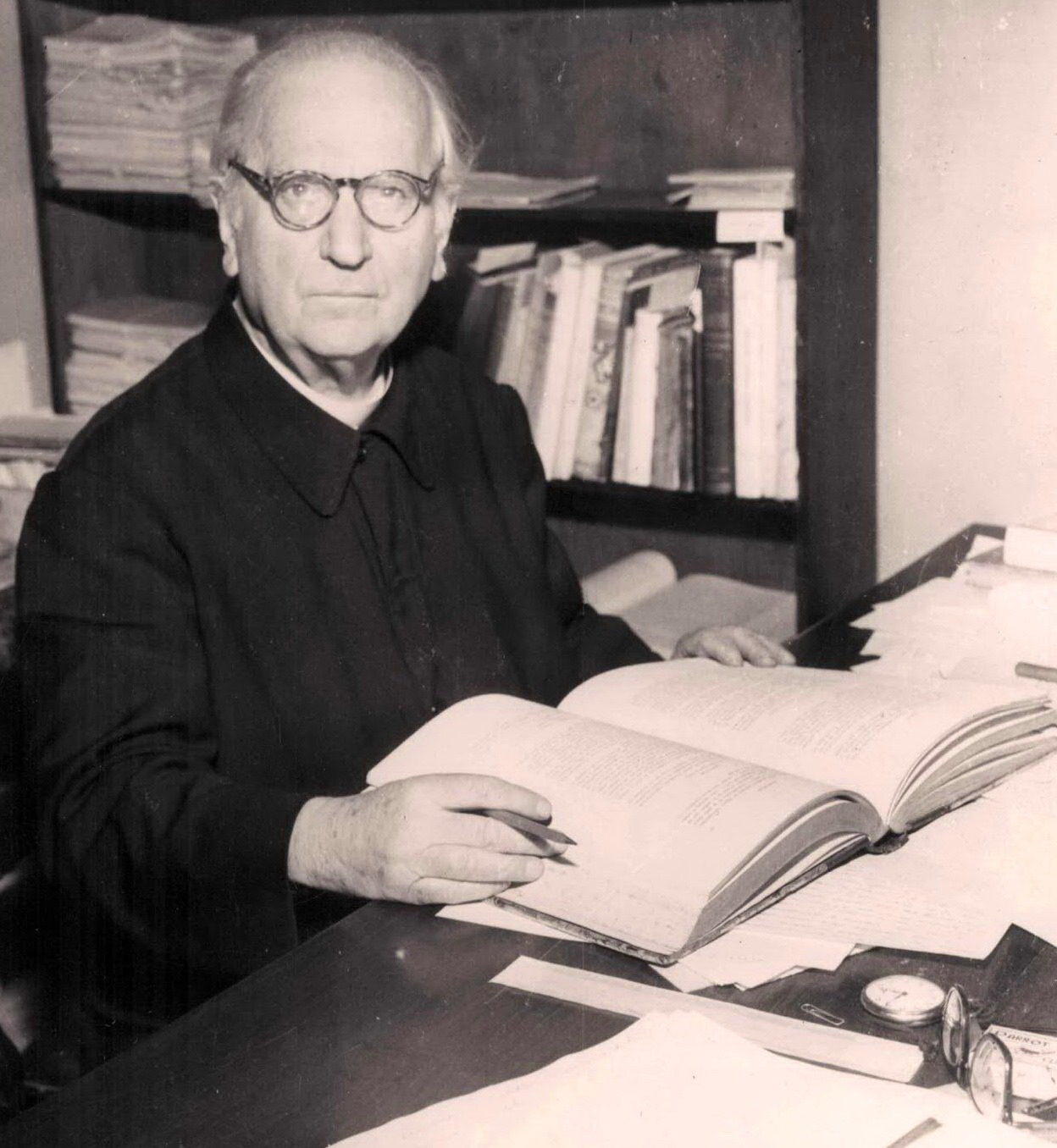
Pedro Grenón S.J.: un sacerdote-historiador icónico de Córdoba
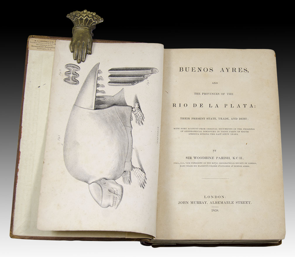
Karl Oenike, un dibujante alemán desconocido y sus viajes por Argentina
Breve historia de la vida de Emma. Lino Enea Spilimbergo y la naturalidad del vigor
El triunfo del Arte Prehispánico: a propósito de la exhibición Antes de América: fuentes originarias en la cultura moderna
Prilidiano Pueyrredón. Un pintor en los orígenes del arte argentino, en el Museo Nacional de Bellas Artes
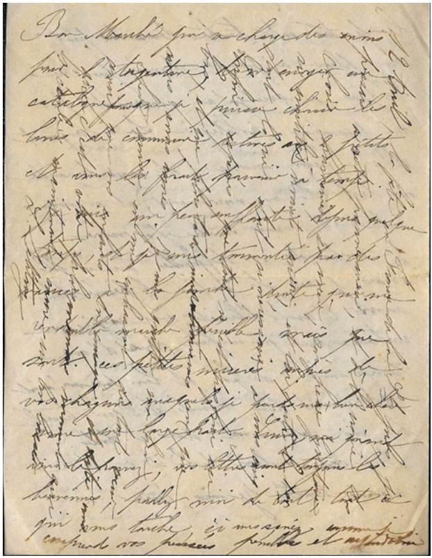
Cartas difíciles: la escritura cruzada
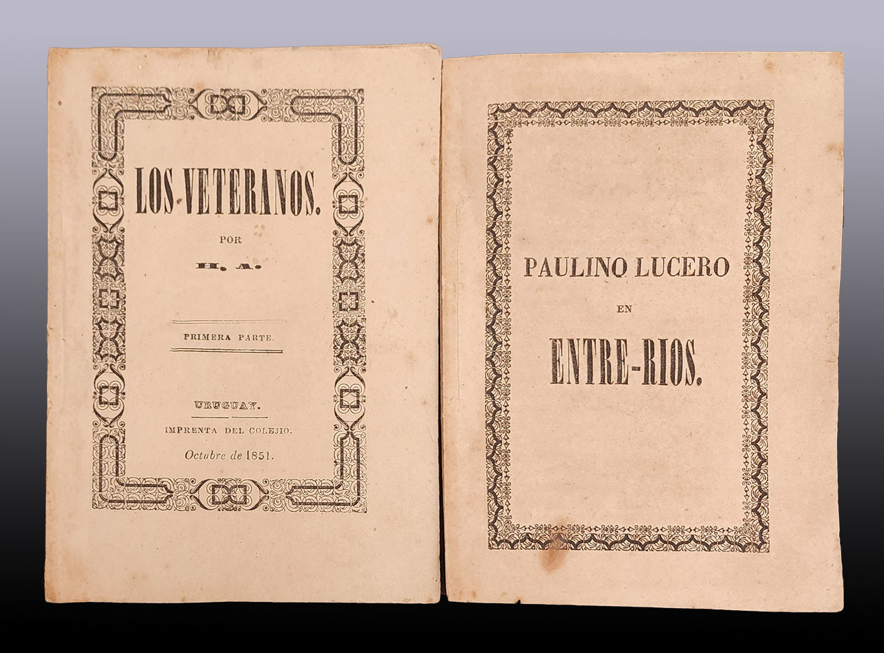
Hilario Ascasubi y Justo José de Urquiza
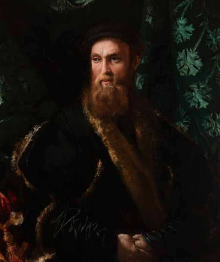
Un reencuentro con mi amigo Benvenuto Cellini, orfebre y escultor
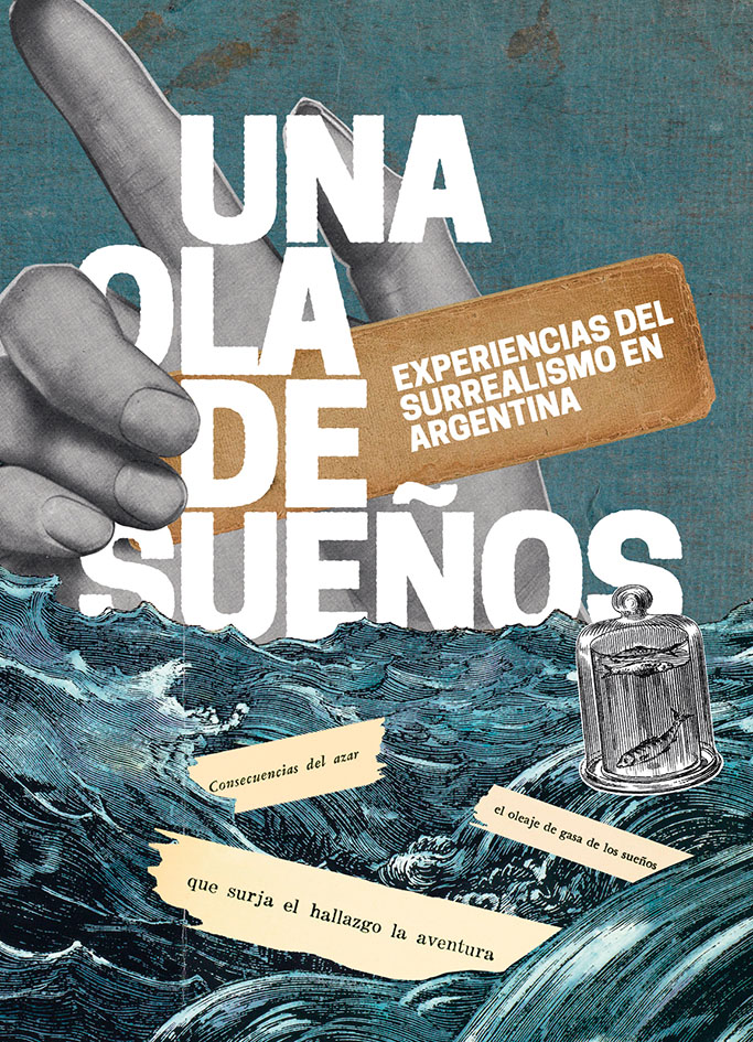
Una ola de sueños, una exposición sobre surrealismo en Argentina en la Biblioteca Nacional
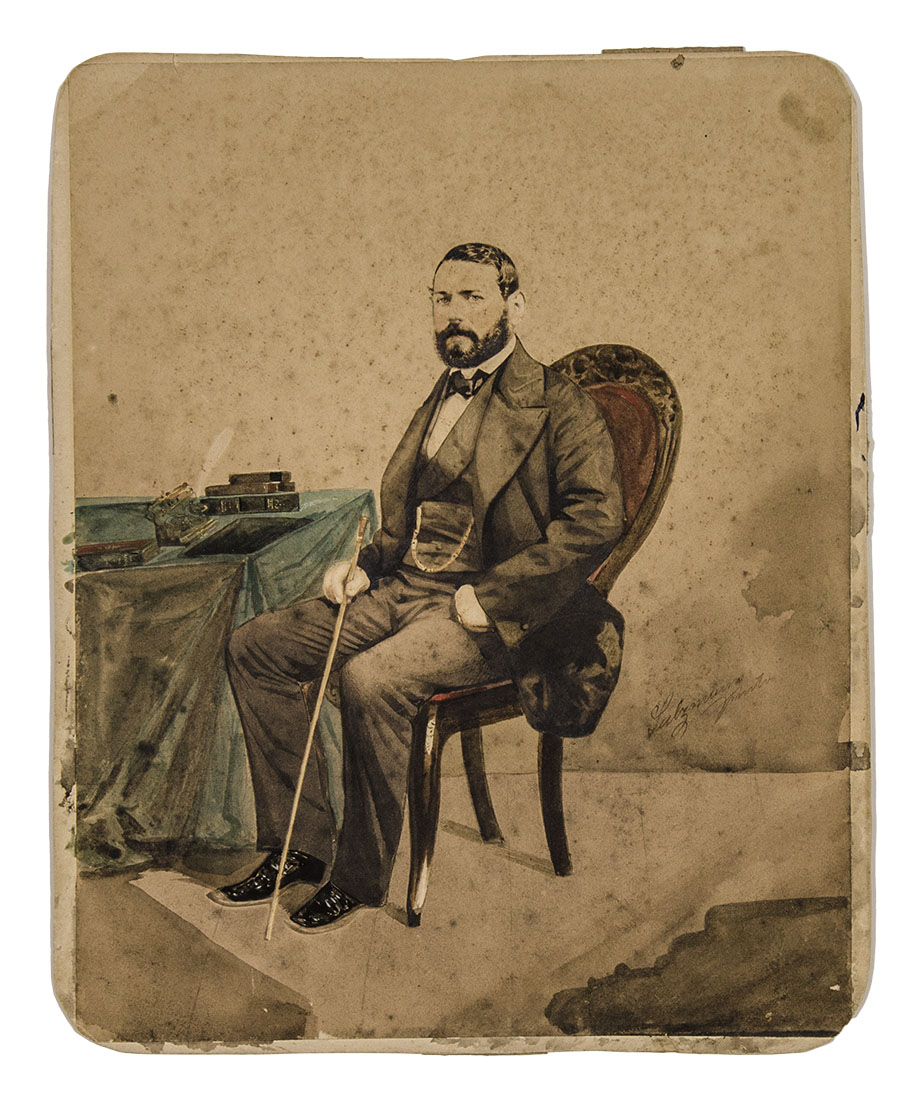
Jorge Sulzmann y su arte de pintar fotografías a mediados del siglo XIX
La silla y el gliptodonte: dos historias genovesas (con una pizca napolitana)
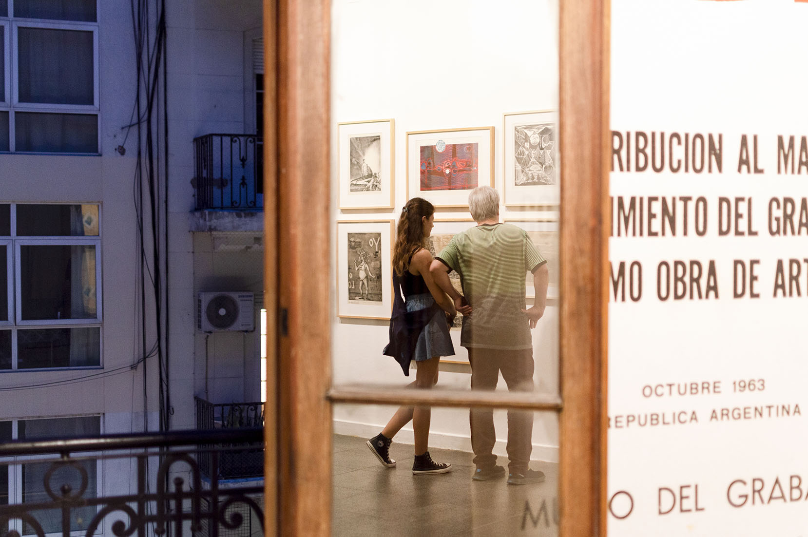
Un recorrido por los núcleos de Primeros tiempos. La invención del Museo del Grabado
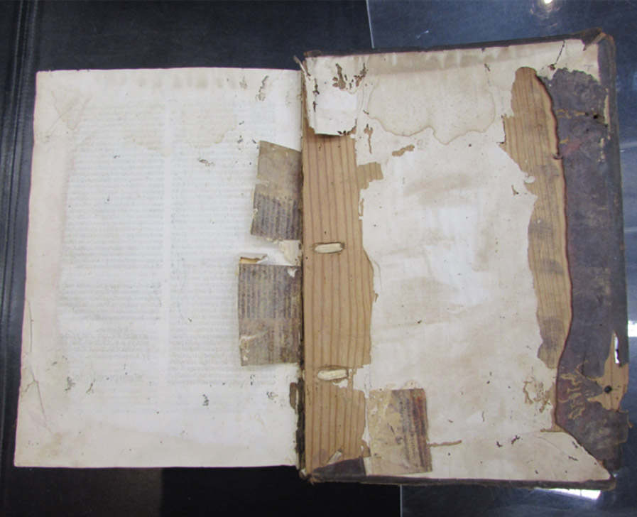
Rescatando del olvido libros mutilados y manuscritos descartados. Se los estudia en ejemplares reutilizados en la imprenta y en la confección de antiguas encuadernaciones
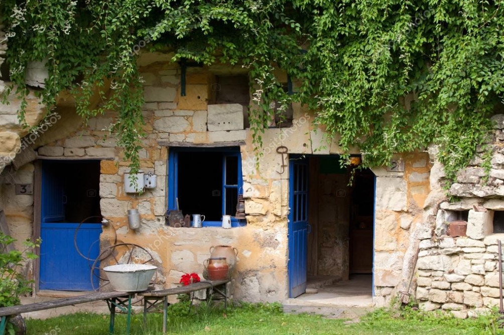
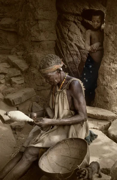
Escenas de la vida troglodita
Del Universo como un telar, de la urdimbre como la vida, de las alegrías y pesares como tramas
Ruth Corcuera (1929 - 2023) Las tramas de una vida generosa
Somos parte de la tierra y ella es parte de nosotros
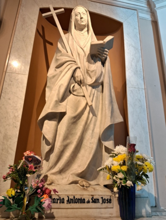
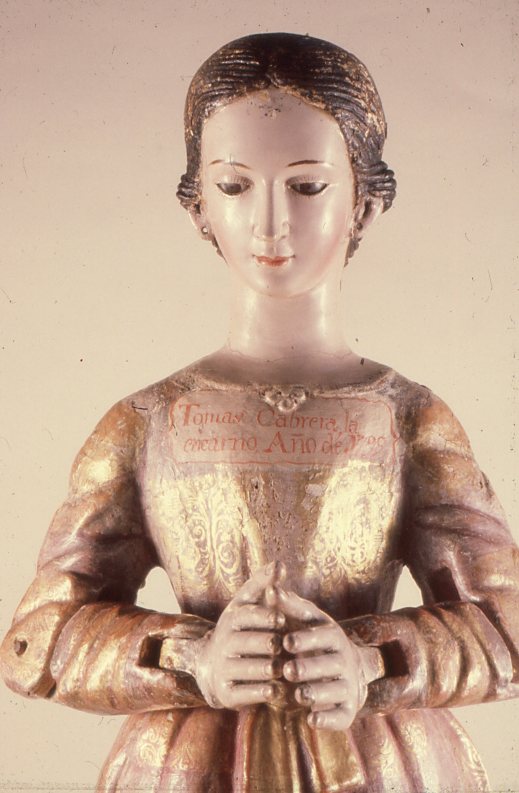
Mama Antula, ¿afroargentina del tronco colonial? Indicios en vista a su inminente canonización
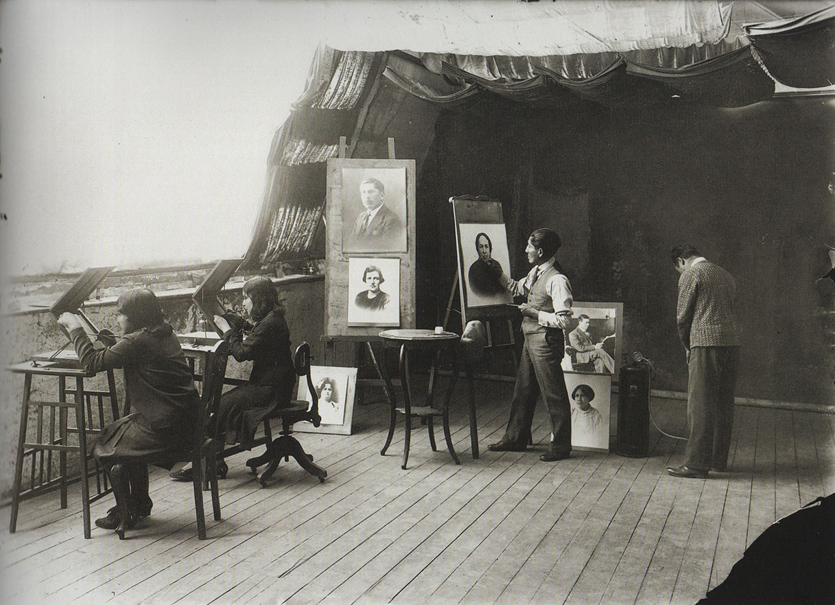
El talentoso fotógrafo Lázaro Sudak. Una cámara al servicio del Teatro Colón
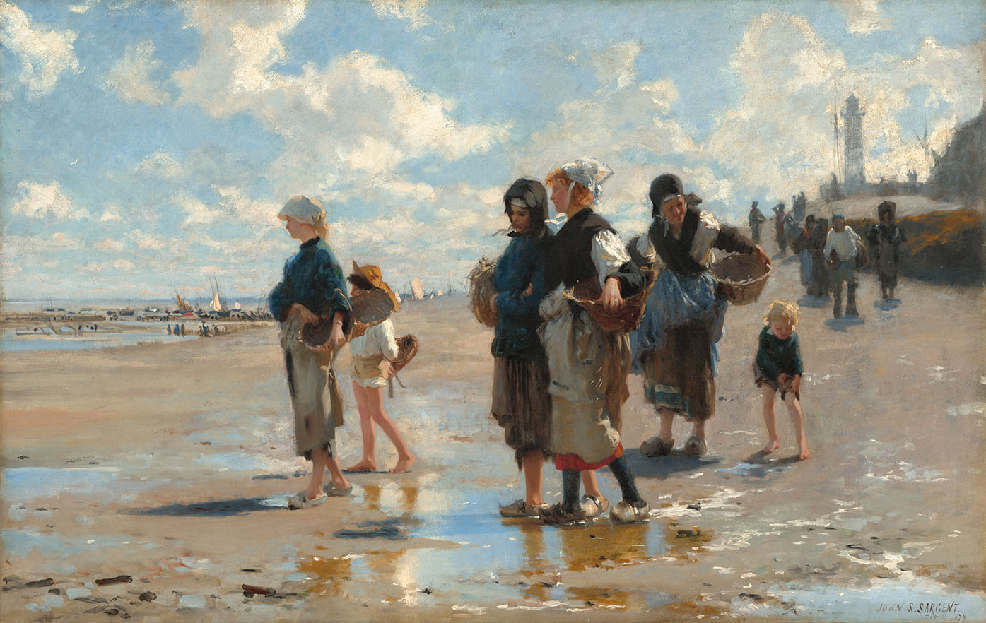
John Singer Sargent, de la Academia a la libertad expresiva *
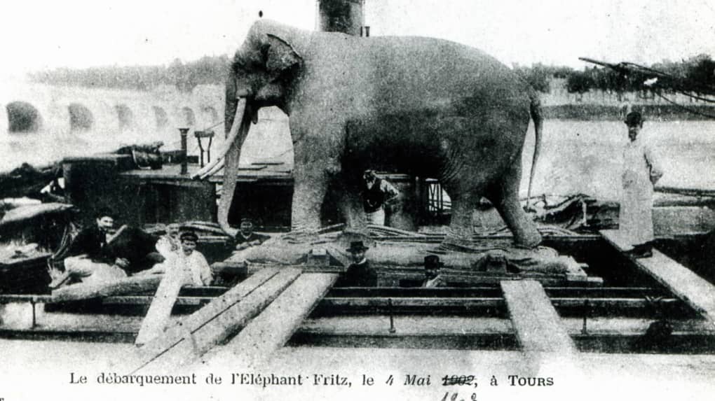
Historias de furia elefantina *
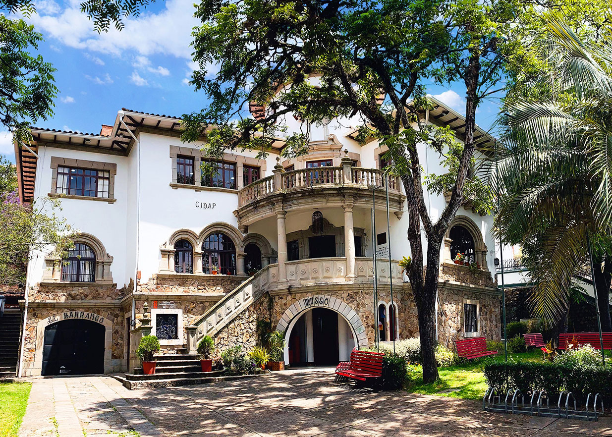
El resguardo de la memoria artesanal *
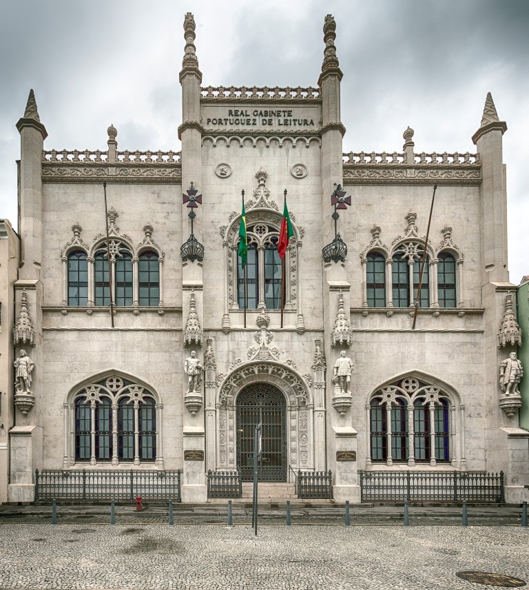
Excursión al Real Gabinete Portugués de Lectura, en Río de Janeiro *
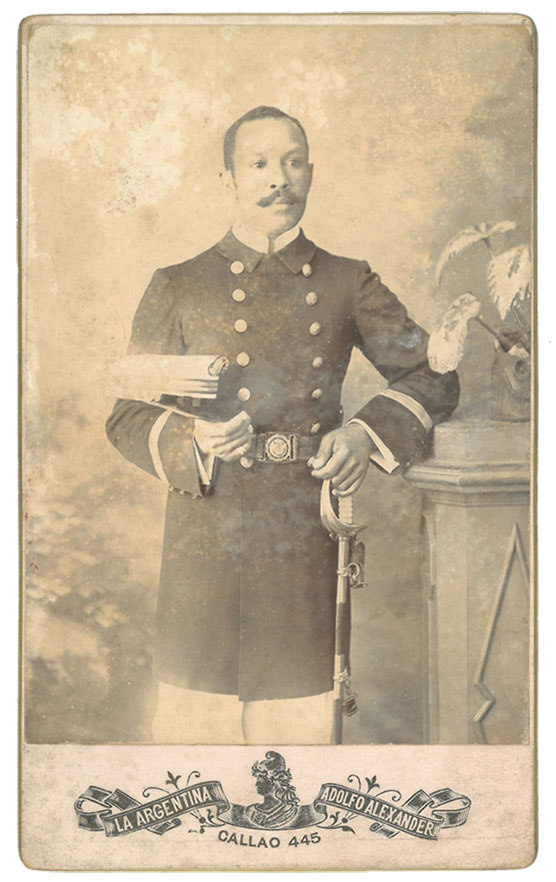
Eduardo Magee. Un afroargentino en la Armada y la masonería *
La experiencia de inventariar el patrimonio cultural nacional
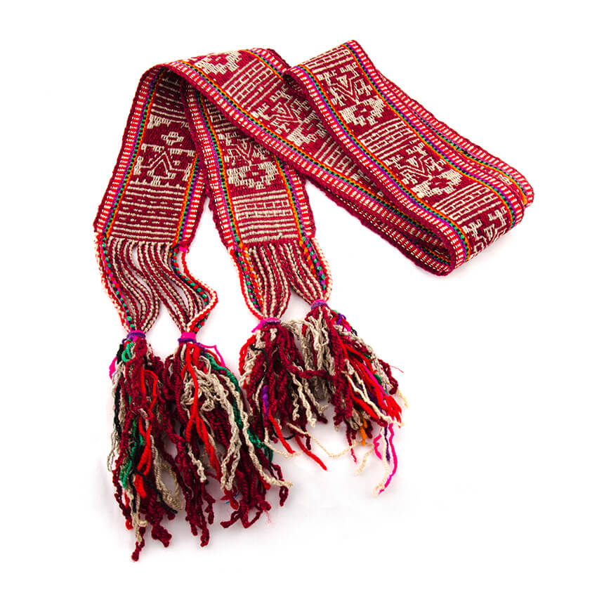
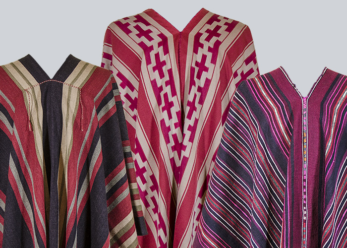
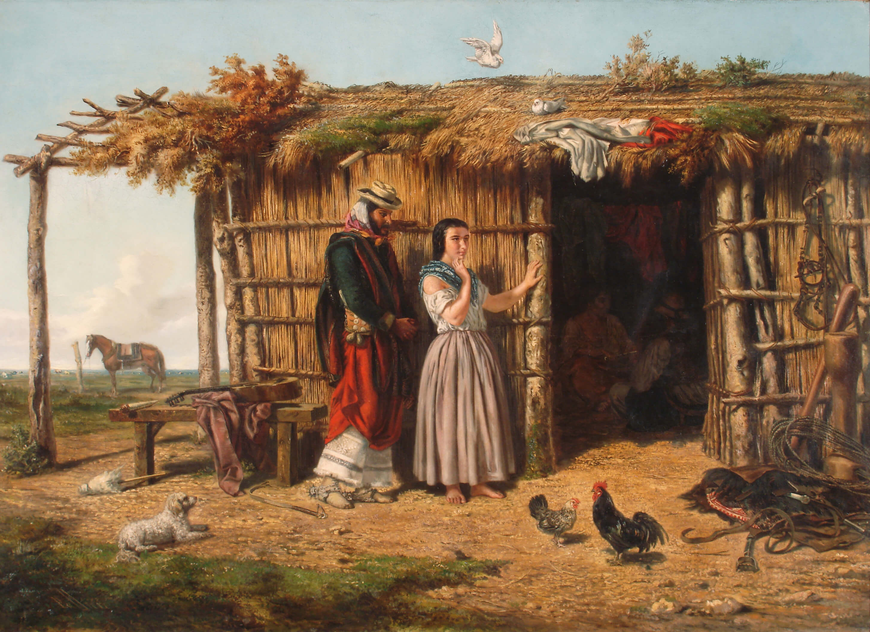
Símbolos y diseños indígenas en las vestimenta de gauchos/gaúchos sudamericanos
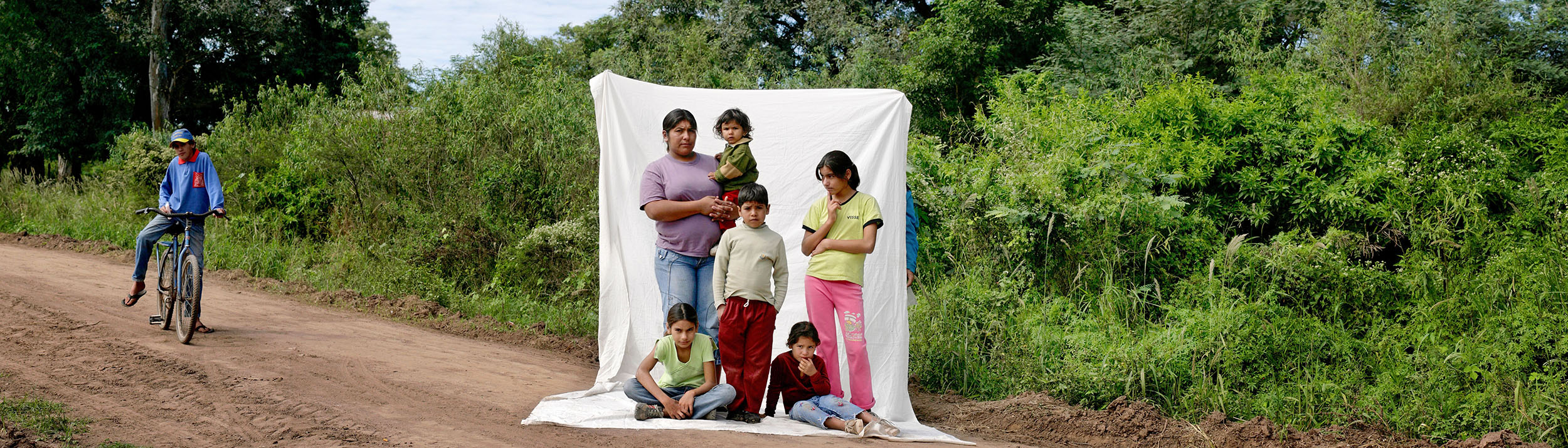
Julio Pantoja, un corazón fotógrafo
La circulación de la cultura impresa en ambas márgenes del Plata, jalones de nuestra historia
Esbozando veredas por las que transitar
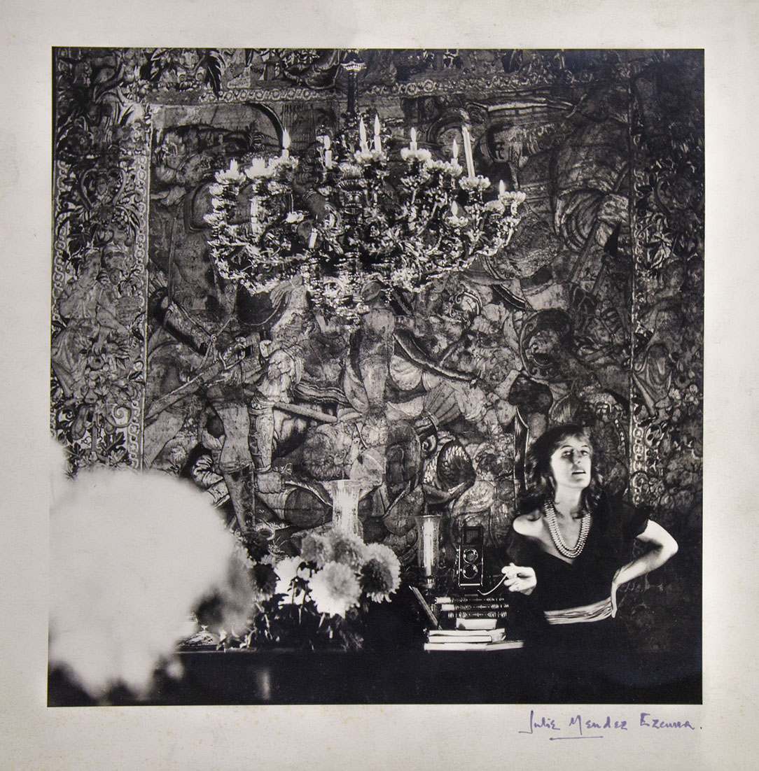
Julie Méndez Ezcurra, una fotógrafa inolvidable
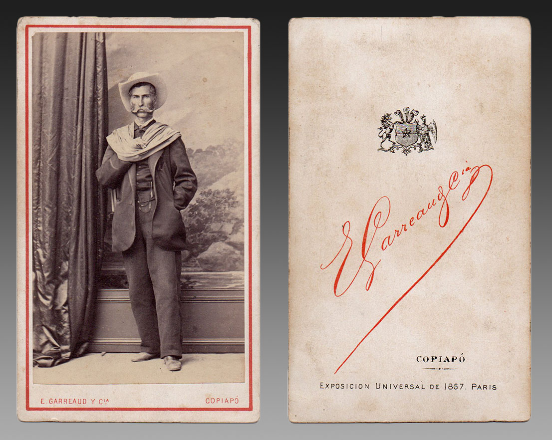
París 1867: Escenificación de gauchos rioplatenses en la Exposición Universal
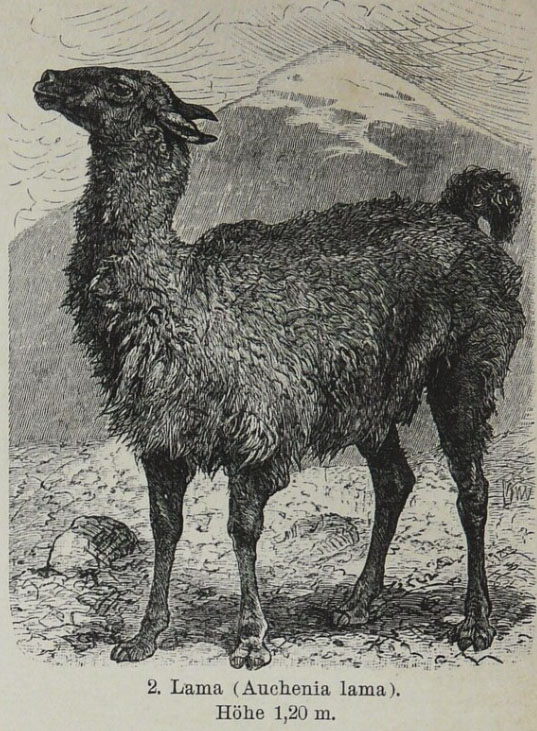
La llama australiana
María Luisa Bemberg se encontró a sí misma y su propia estética en el arte rioplatense
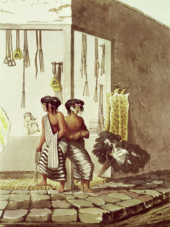
Símbolos y diseños indígenas en las vestimenta de gauchos/gaúchos sudamericanos
La representación de las mujeres en la obra de Elena Huerta [1]
Maestros de obra / obra de Maestros
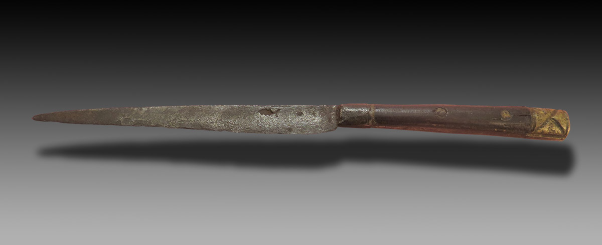
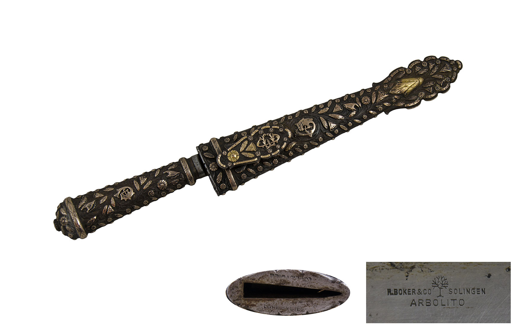
Antecedentes del cuchillo criollo: una invitación al debate [1]
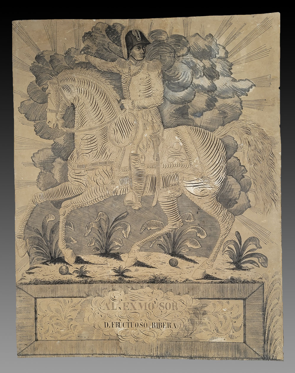
Un retrato ecuestre de Fructuoso Rivera por Juan Manuel Besnes e Irigoyen
Cuando el mate era diferente: acerca de bernegales y apartadores
El reptil de la calle Greifenhagener
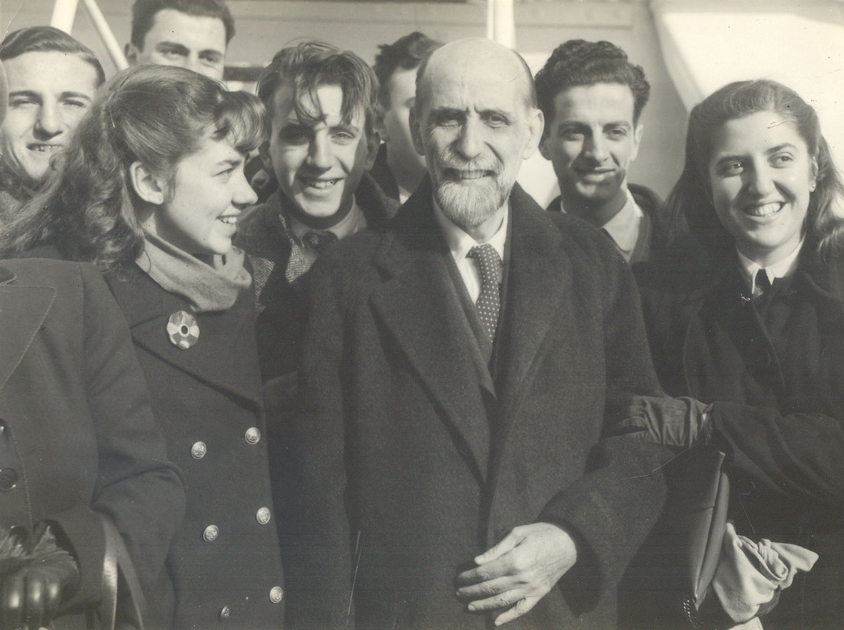
Juan Ramón Jiménez, 1948. 75 años de un viaje al Río de la Plata
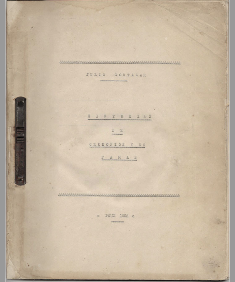
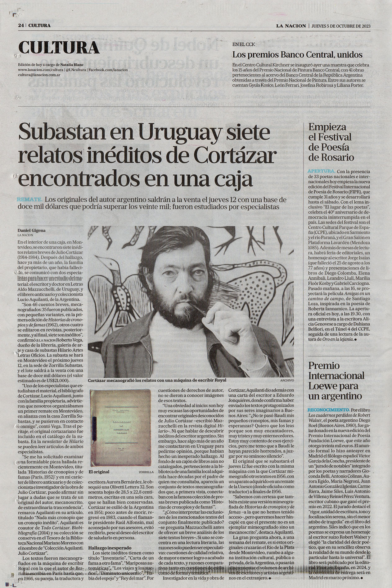
Valioso conjunto de inéditos de Cortázar surge del fondo de un cajón
Nada más cronopio, que un cronopio inédito
El Novecientos uruguayo: un mapa crítico
De ellas dos: un viaje a través de la biblioteca de Matilde Pacheco y Ana Amalia Batlle
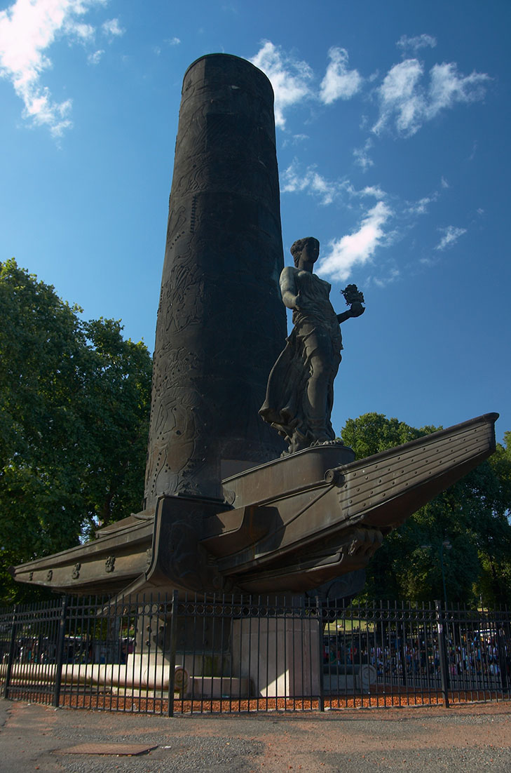
El monumento de la cordialidad rioplatense realizado en Buenos Aires
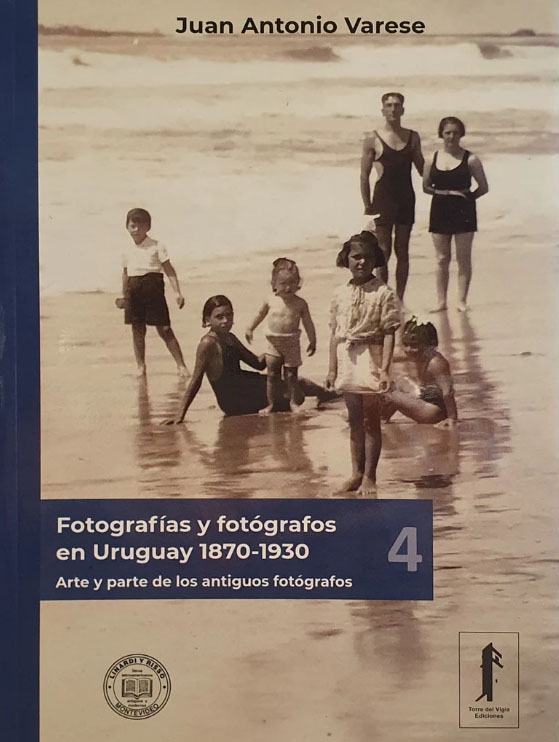
Arte y parte de los antiguos fotógrafos
Venta de huesos y papeles en el Río de la Plata

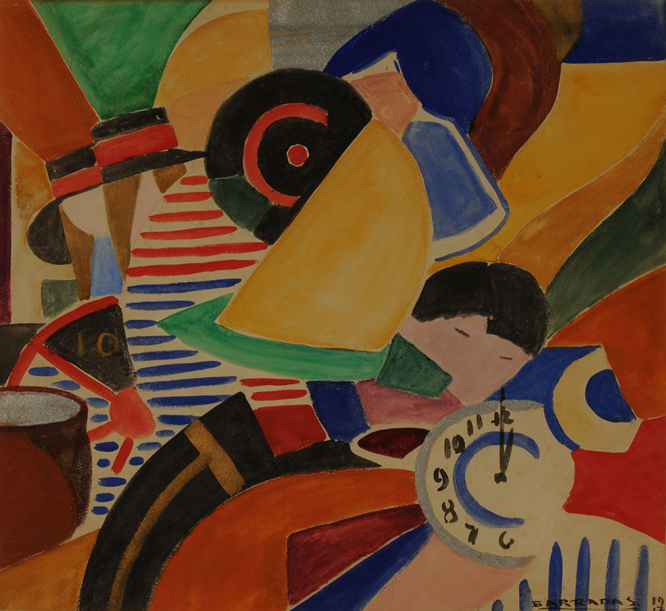
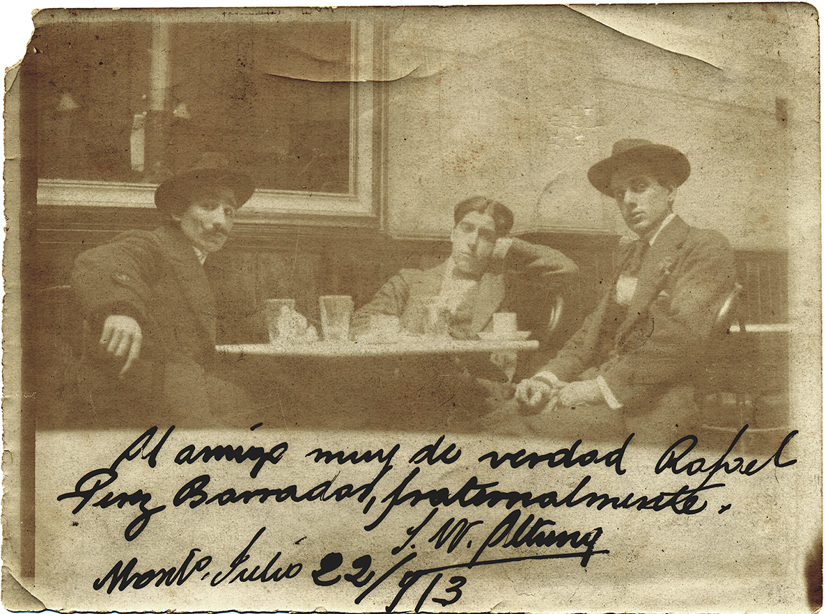
Rafael Barradas y la libertad creativa
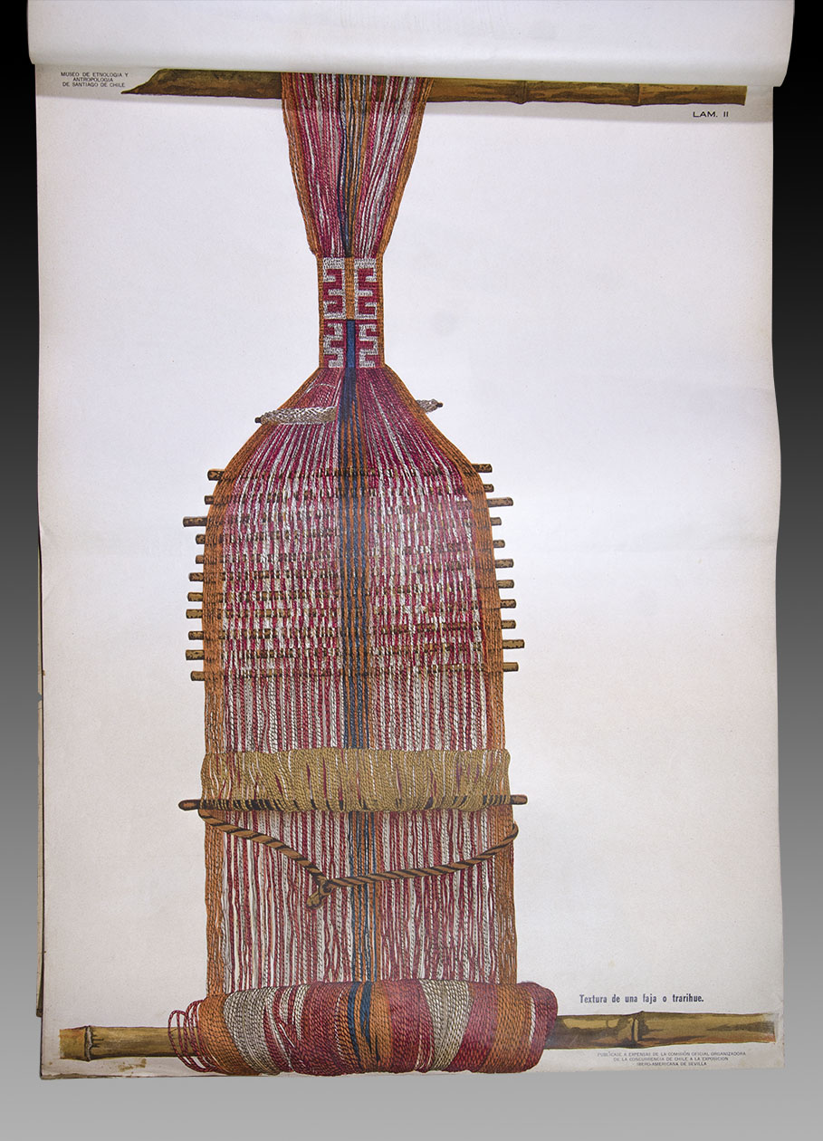
Álbum de Tejidos Araucanos y Alfarería dedicado a la Exposición Iberoamericana de Sevilla de 1929. Una visión actual de la obra.
Nuevas correspondencias
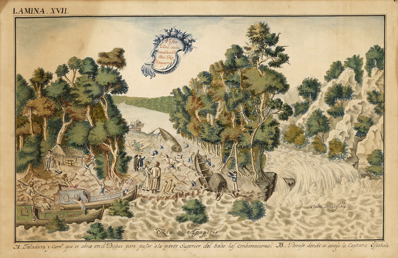
La labor y la soberanía indígena vistas a través de la demarcación de límites entre España y Portugal en la segunda mitad del siglo XVIII
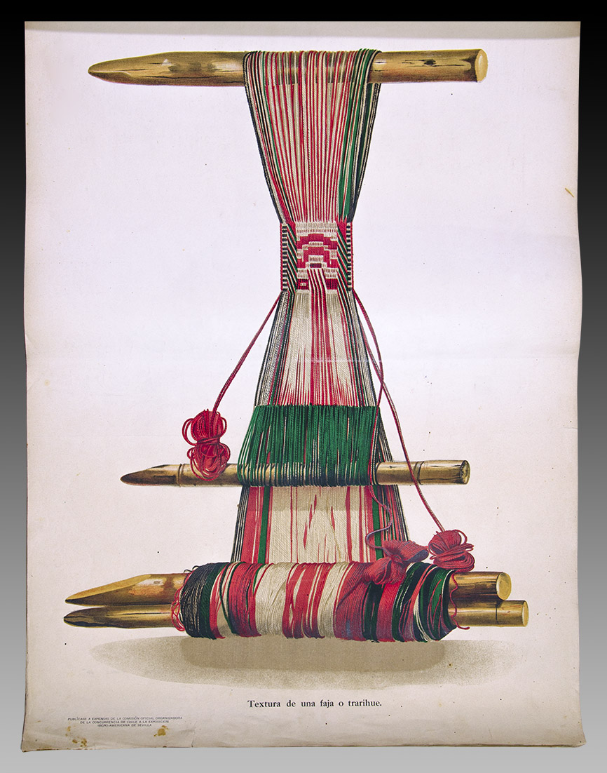
Álbum de Tejidos Araucanos y Alfarería dedicado a la Exposición Iberoamericana de Sevilla de 1929. Una visión actual de la obra
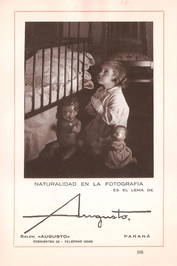
Augusto Vallmitjana, sus años en Paraná
Viaje negro azabache a un antiguo centro de la Tierra
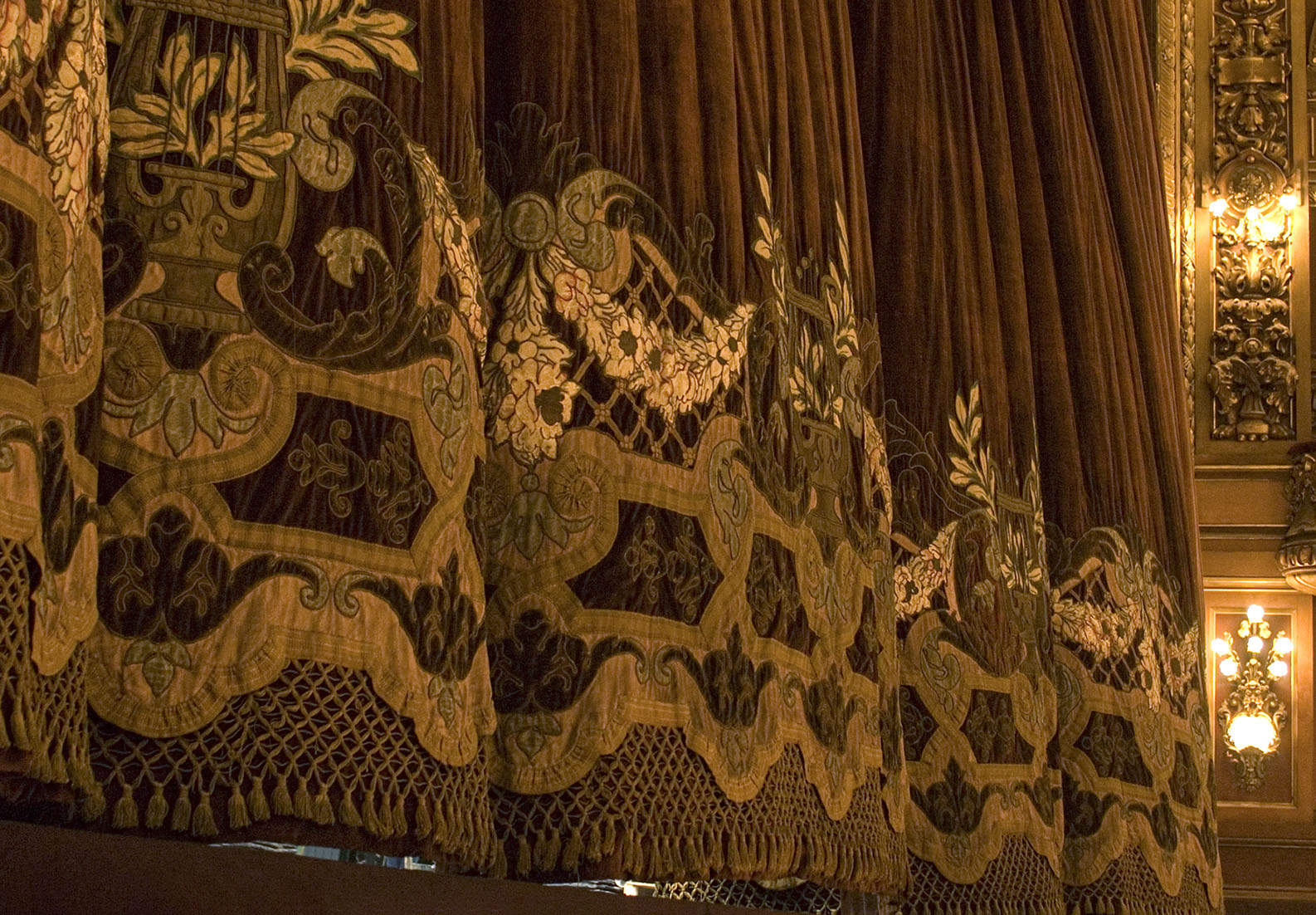
El Teatro Colón y su telón de boca
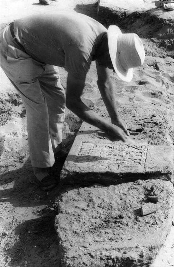
Reseña de un rescate arqueológico en el norte de Sinaí
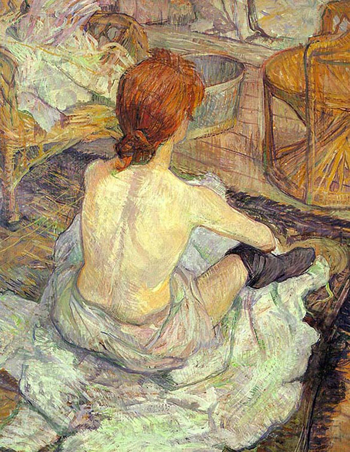
Degas, Toulouse Lautrec y la intimidad femenina
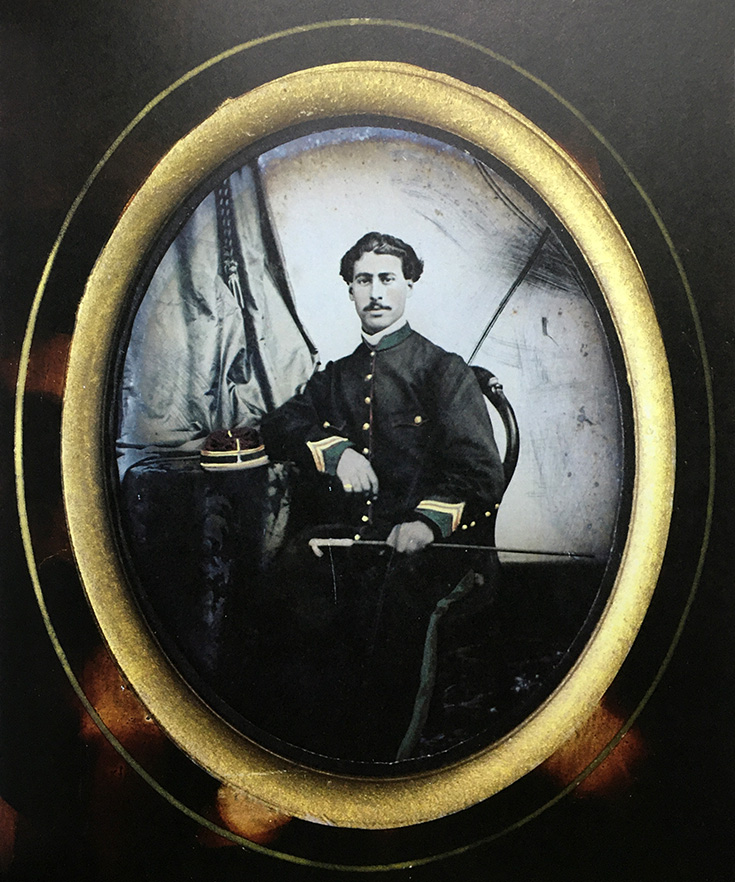
El hallazgo de un inédito retrato fotográfico de Felipe Varela. Sorpresa de los antiguos arcones familiares
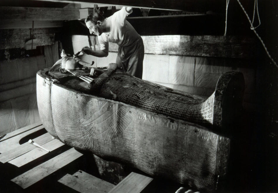
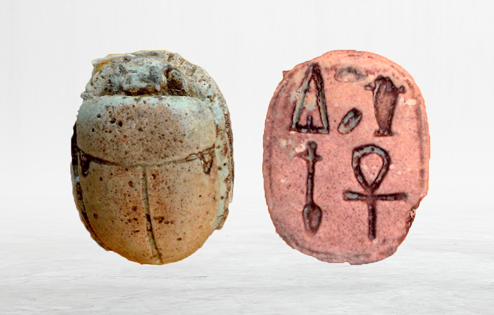
Tutankamón: Un hecho fotográfico
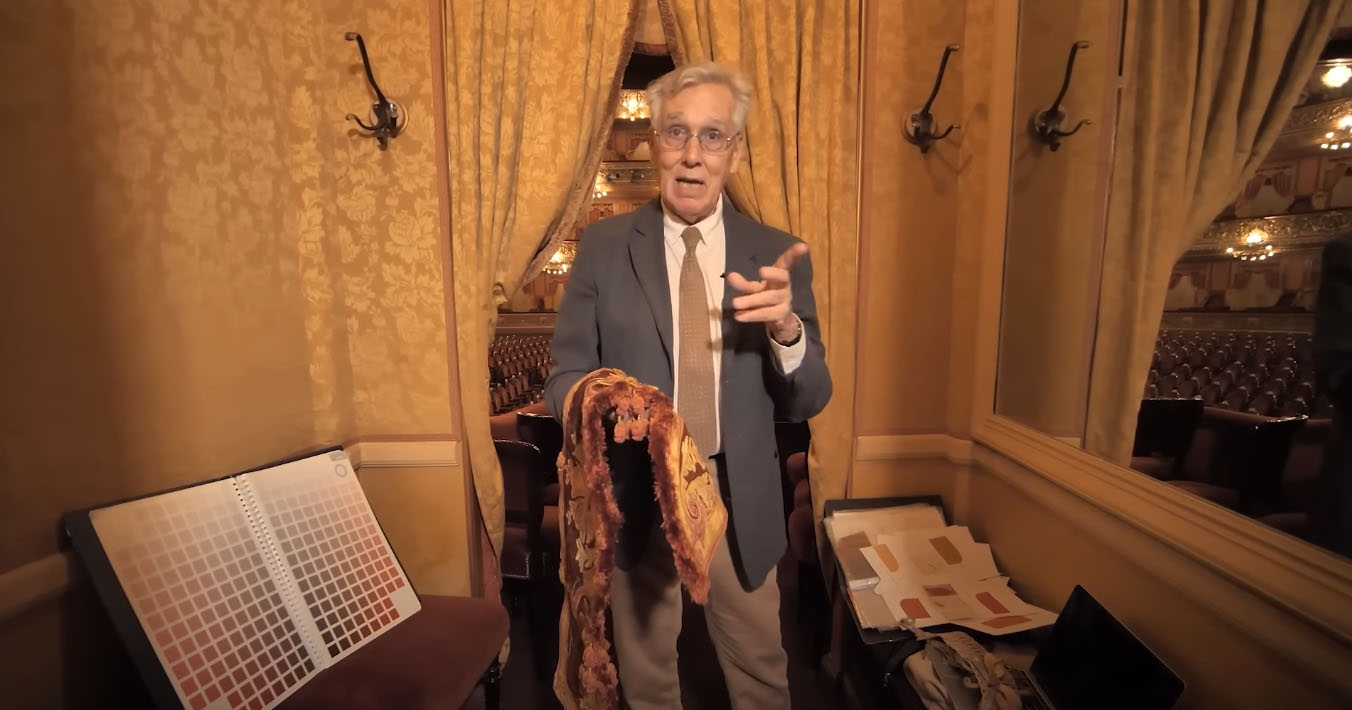
Teatro Colón. El asesoramiento textil al Master Plan del Teatro Colón. 2006-2008
Félix Pitré. Fotógrafo y pintor en Buenos Aires
Circulación de la literatura en pliegos sueltos argentinos y uruguayos en los ámbitos gauchesco y afrodescendiente desde la teoría de la performance
Una colección fotográfica sobre Máksim Litvínov, el hombre que evitó guerras mundiales
Los caballos fósiles de la pampa argentina
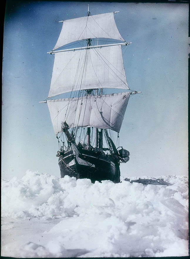
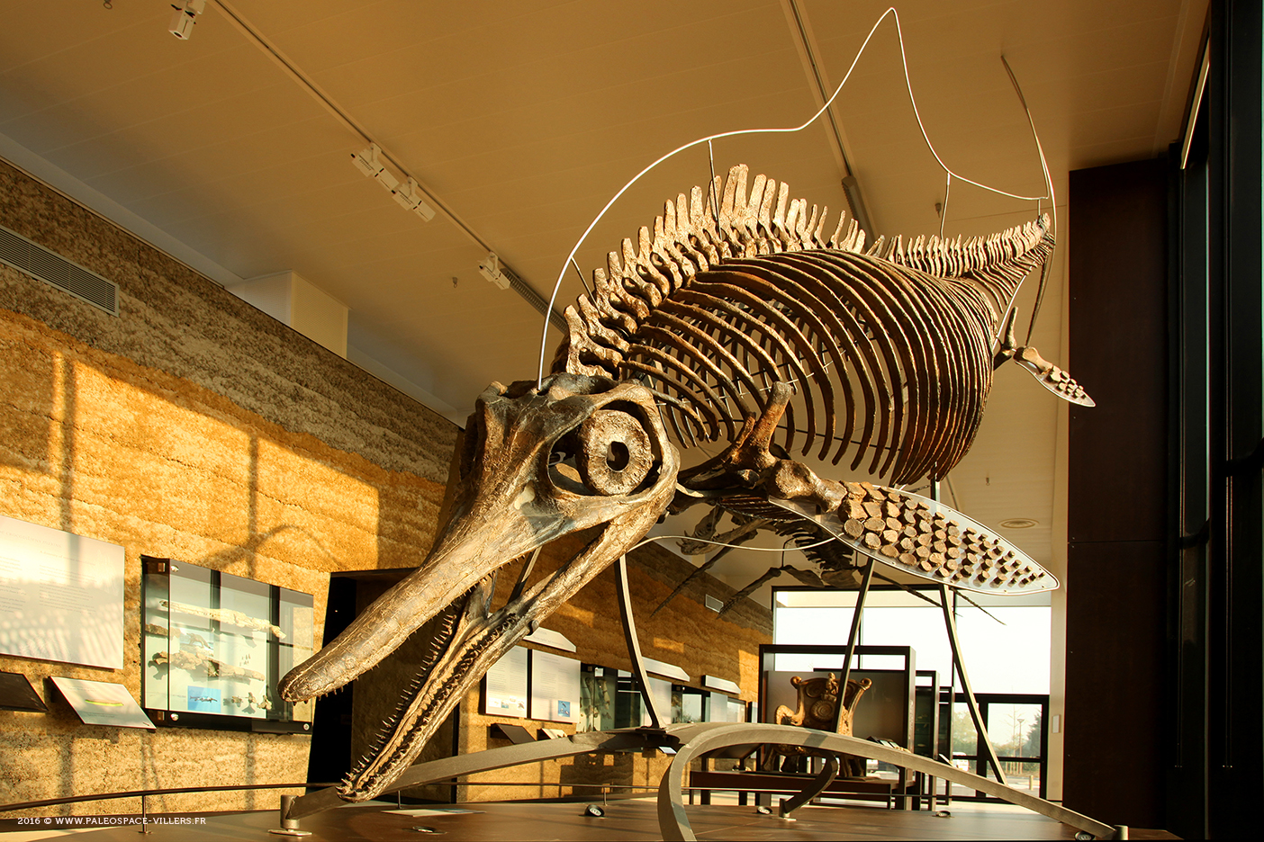
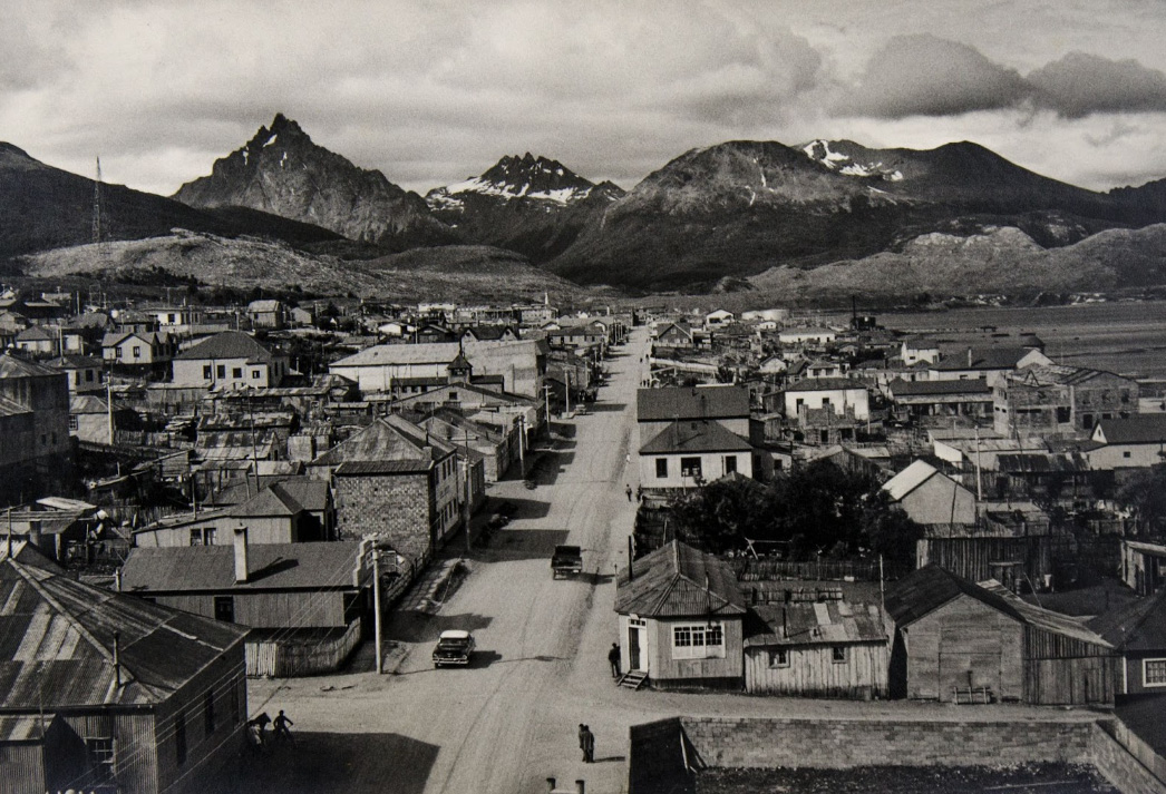
Un poco de hielo para el verano austral
El fotógrafo alemán Herbert Kirchhoff. Un pionero injustamente olvidado
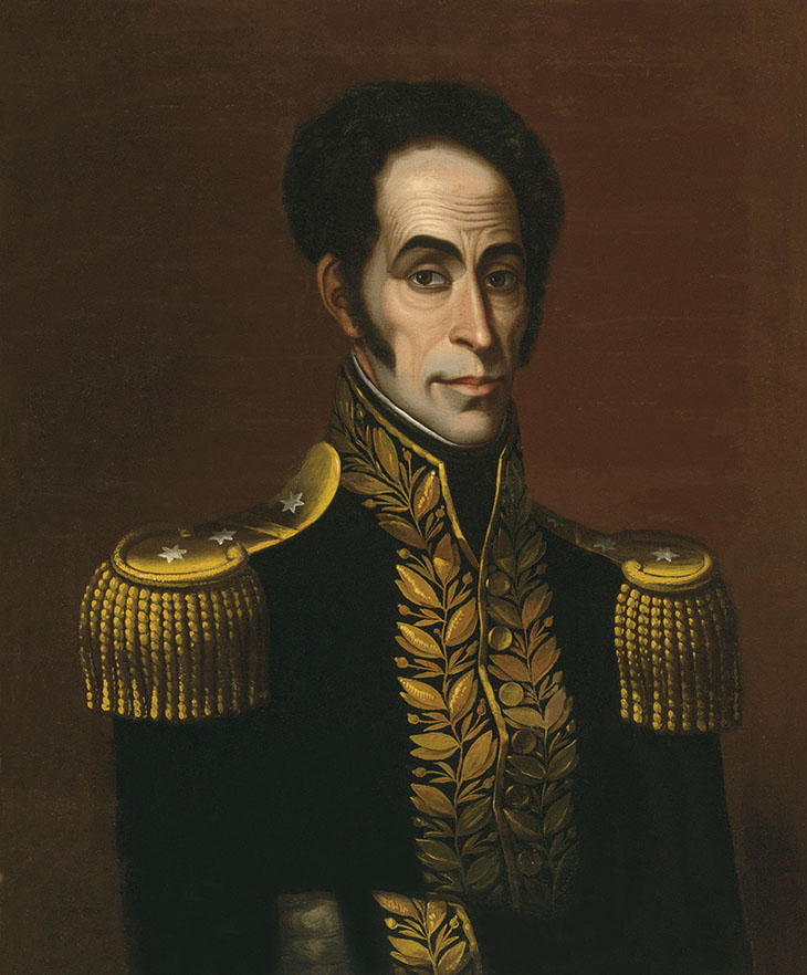
Iconografía de Bolívar: ¿anónimo de 1825 o Francis Martin Drexel de 1827?
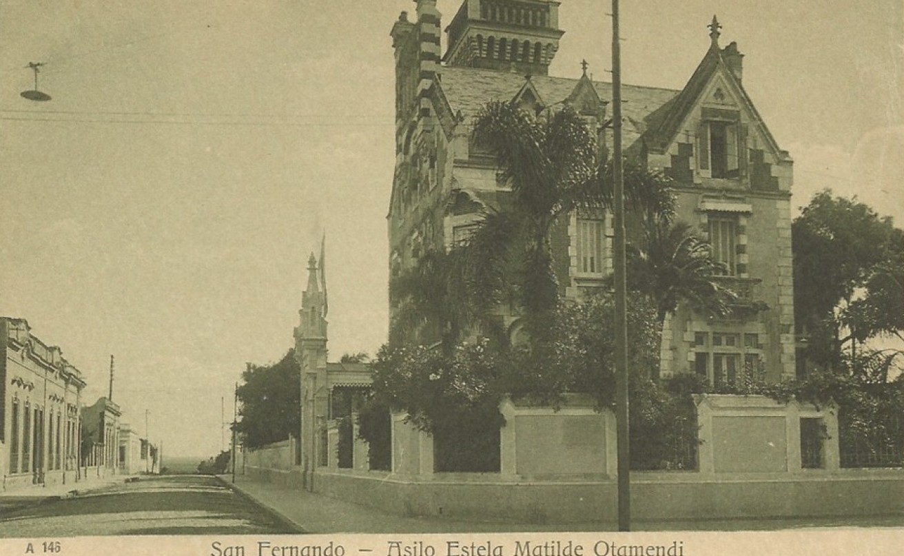
Historia de la fotografía en el Municipio de San Fernando (2º parte)
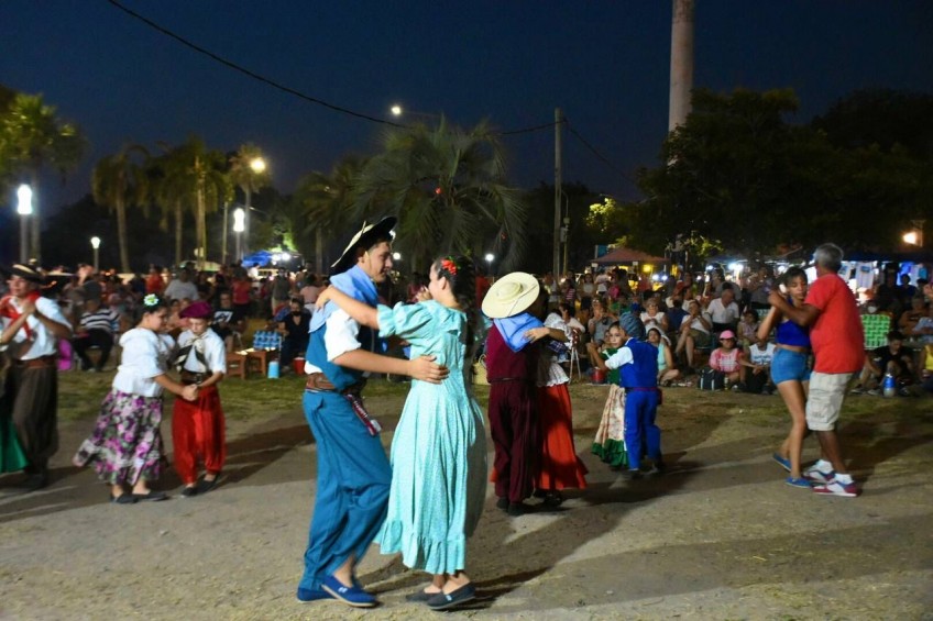
Tango y Chamamé. Dos músicas y danzas patrimoniales de Argentina
El vertedero de la historia
La estética de La mujer araña en una inigualable colección de fotografías
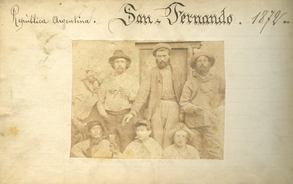
Historia de la Fotografía en el Municipio de San Fernando
El viento, todo lo desparrama
El remate que hizo historia
Obras completas de la familia Platero (proyecto de investigación)
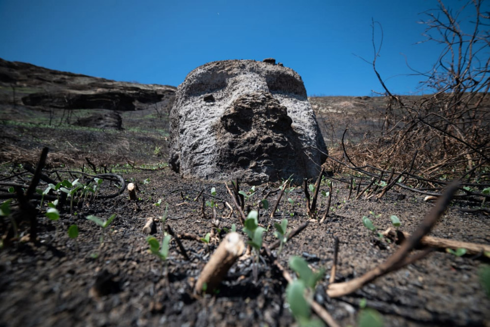
Los moai de la Isla de Pascua o la piedra, también muere
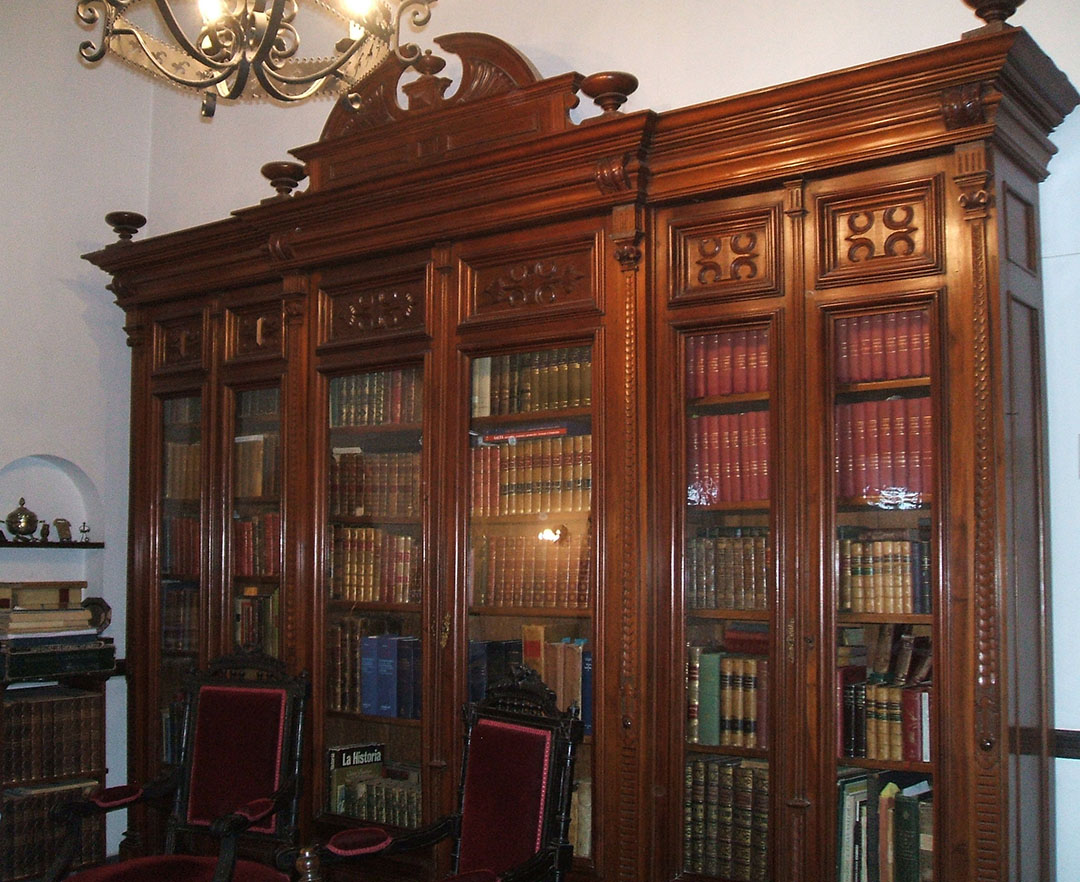
La biblioteca privada J. Armando Caro que se conserva en Salta
Secuencias de la obra de Carlos Colombino. Ocho estadios y un colofón
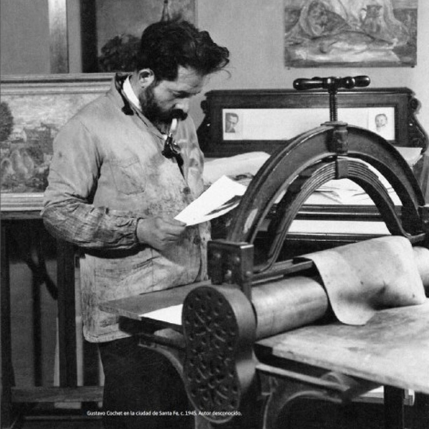
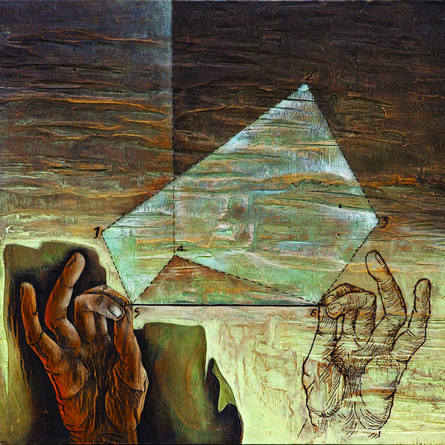
Gustavo Cochet, pintor y grabador del mundo, pero no de Buenos Aires.
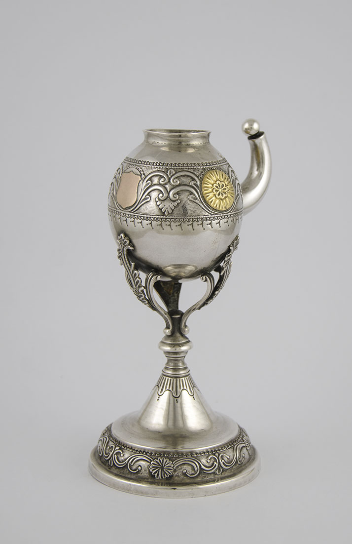
Historia de la platería argentina
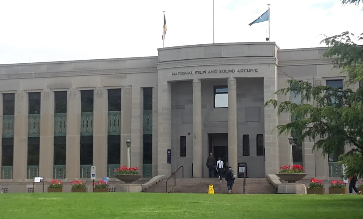
Un museo desaparece: la corta y triste historia del Instituto Australiano de Anatomía de Canberra
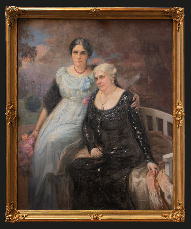
Las dos Victorias
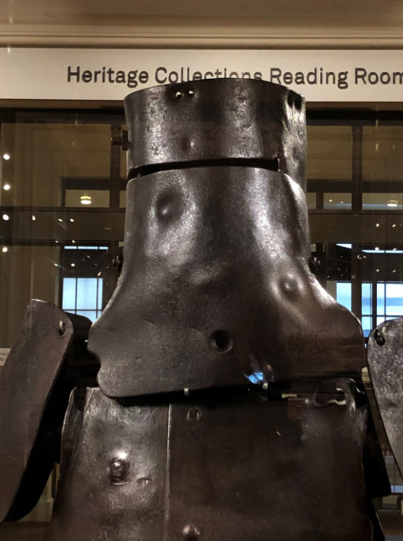
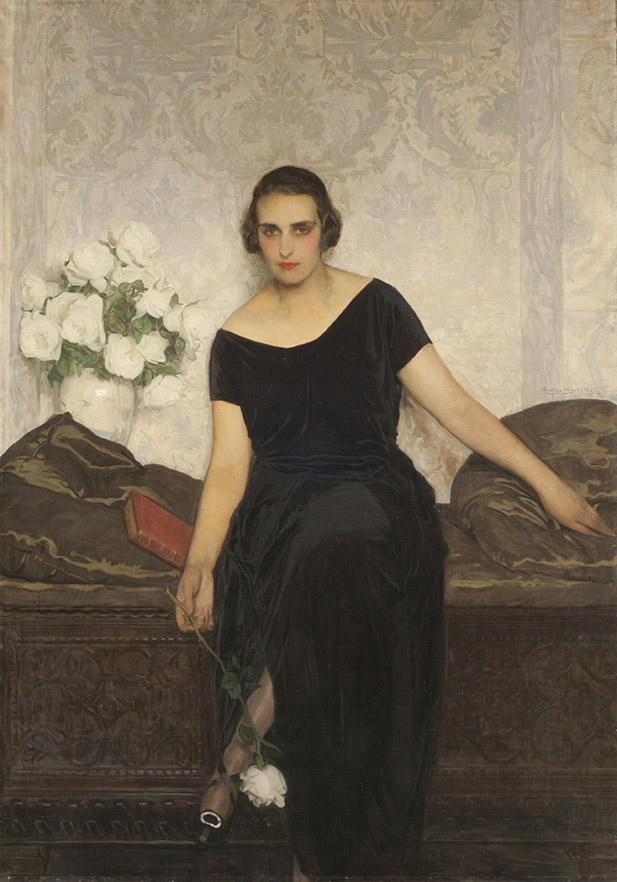
Una armadura para la Cruz del Sur.
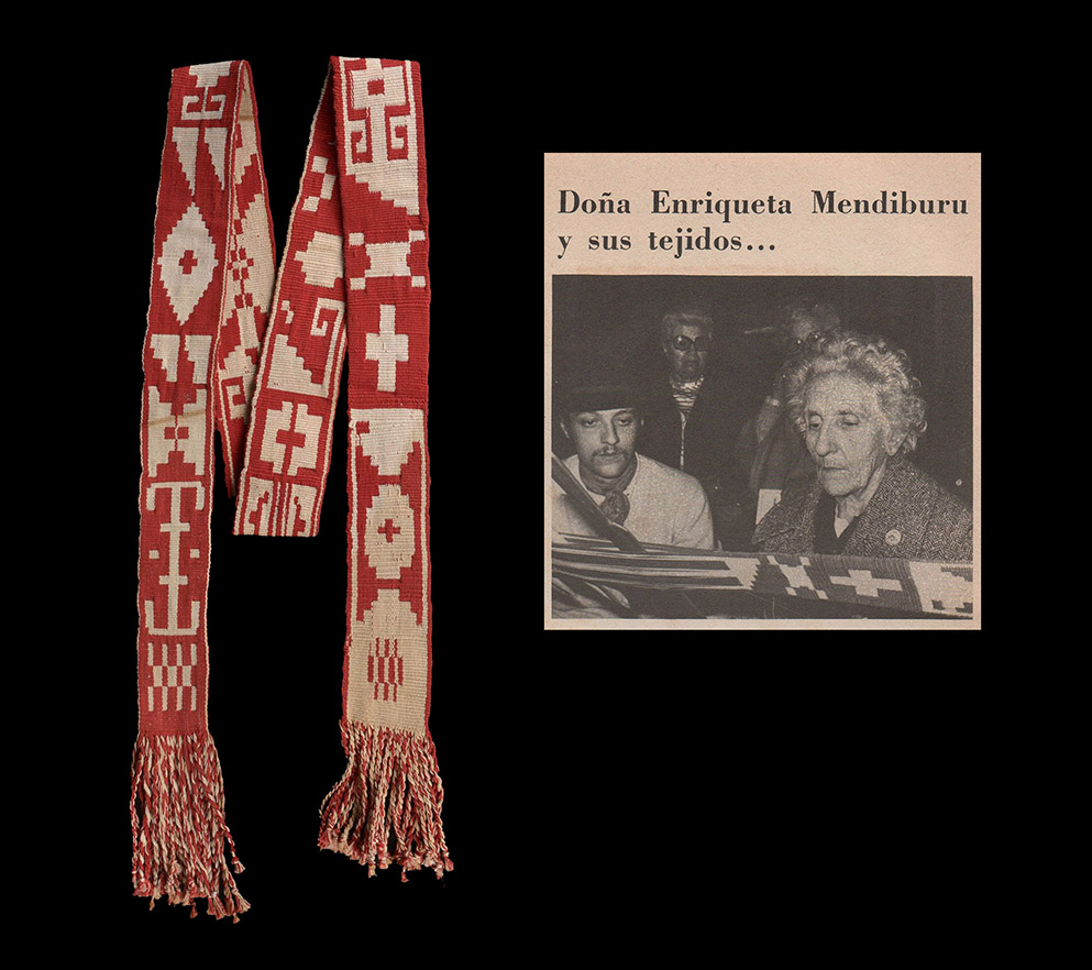
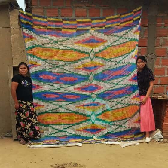
La tejeduría pampa azuleña: Ponchos y fajas. Su decoración.
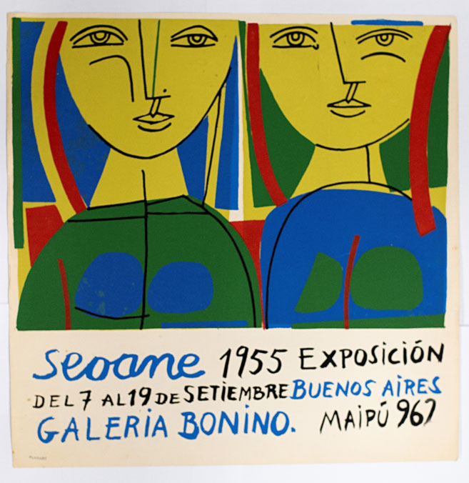
Sobre la exposición Materiales Seoane. Entre Galicia y Argentina
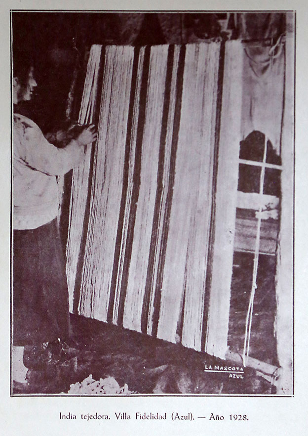
La Tejeduría Pampa azuleña: ponchos y fajas.
Una momia egipcia en Buenos Aires: nuestro temperamento húmedo le es ingrato.
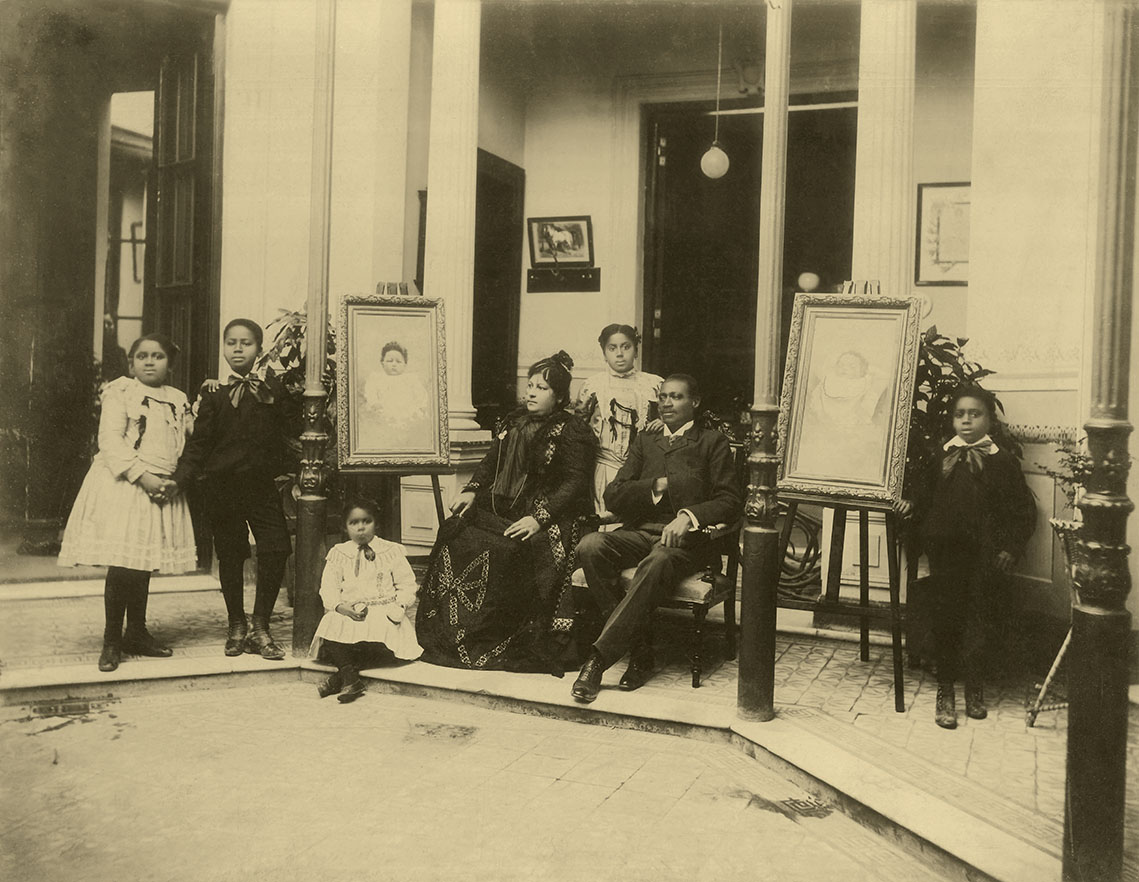
Fotografiando el presente afroargentino: la Colección Destéfano.
Catamarca, baluarte del oficio de tejer.

William Henry Hudson, un faro hacia la literatura.

Cecilia Vicuña: De lo precario a lo trascendental.
Algunos apuntes sobre Alfredo González Garaño.
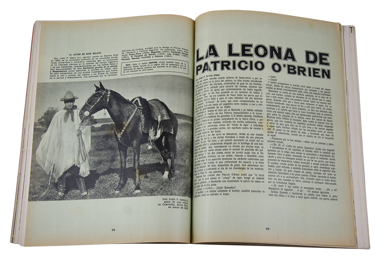
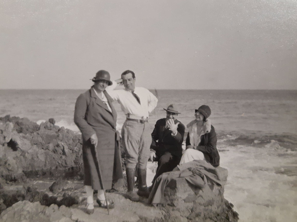
Justo P. Sáenz (h) y el mundo criollo.

La katana y uno de sus grandes maestros, Ōsumi Toshihira.
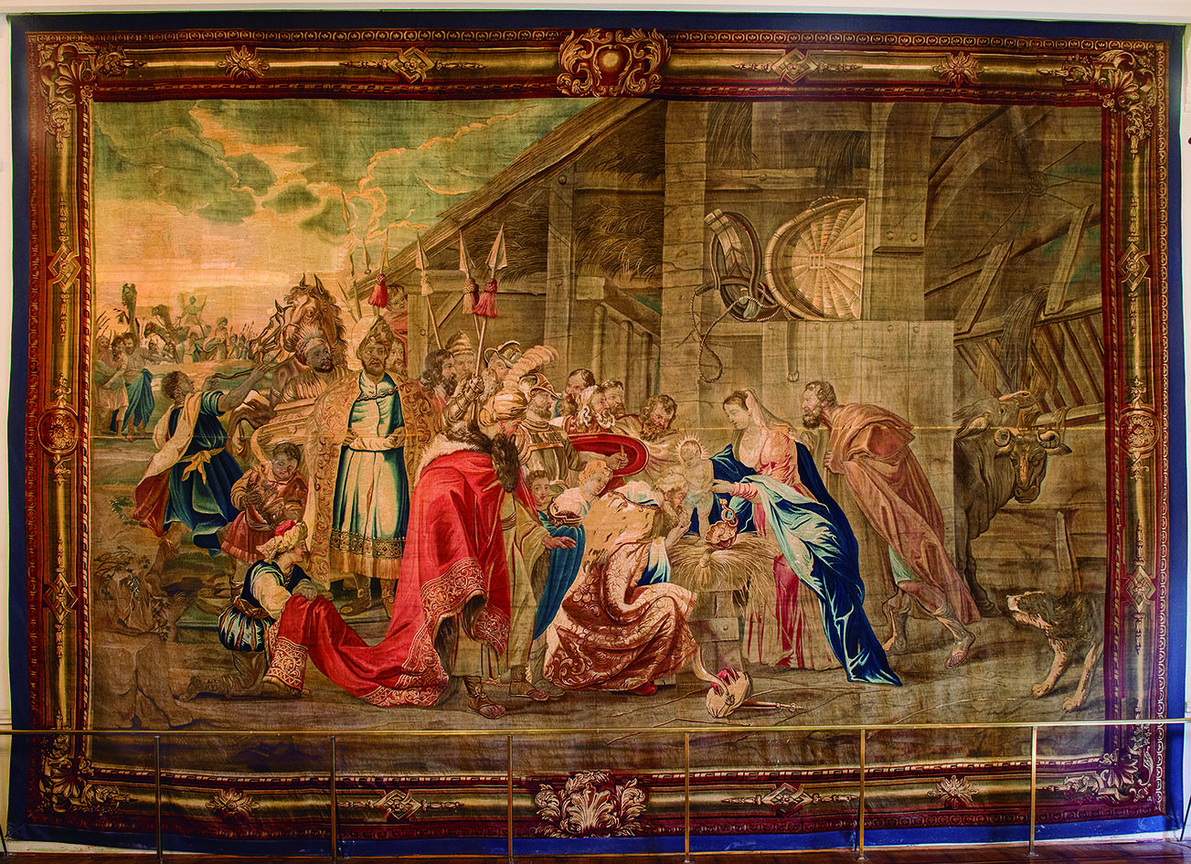
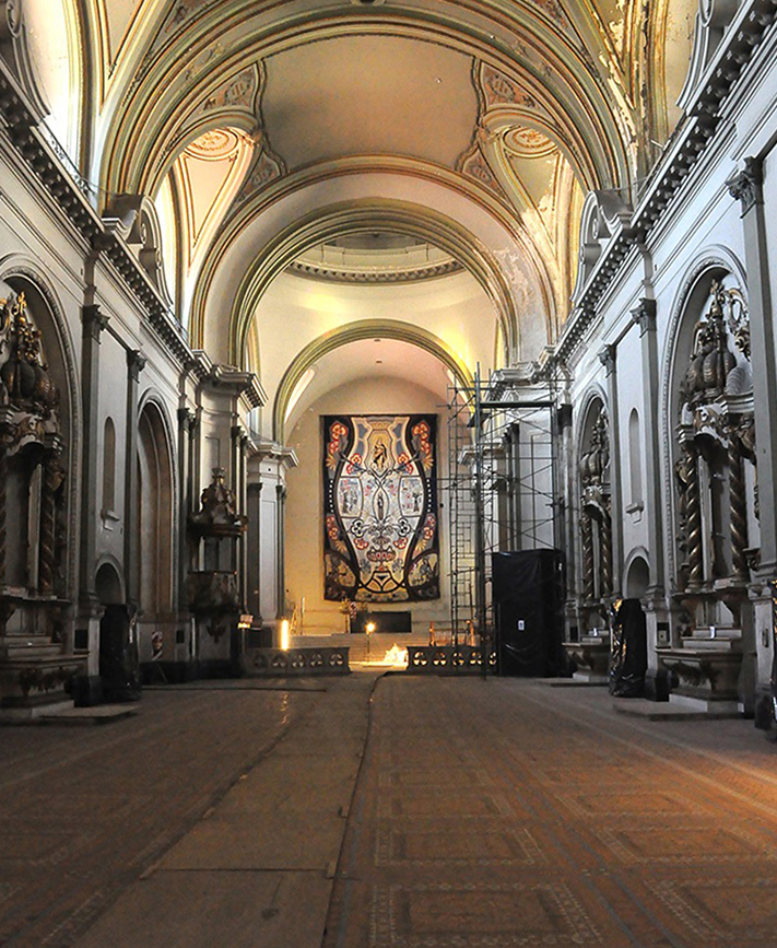
El tapiz de la Adoración de los Magos en Buenos Aires

Una bolsa de piel de lobo
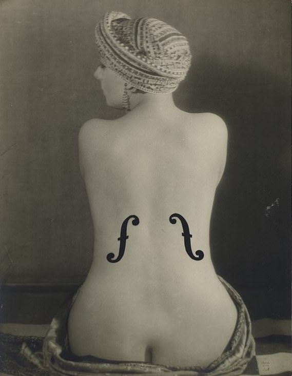
El violín de Ingres
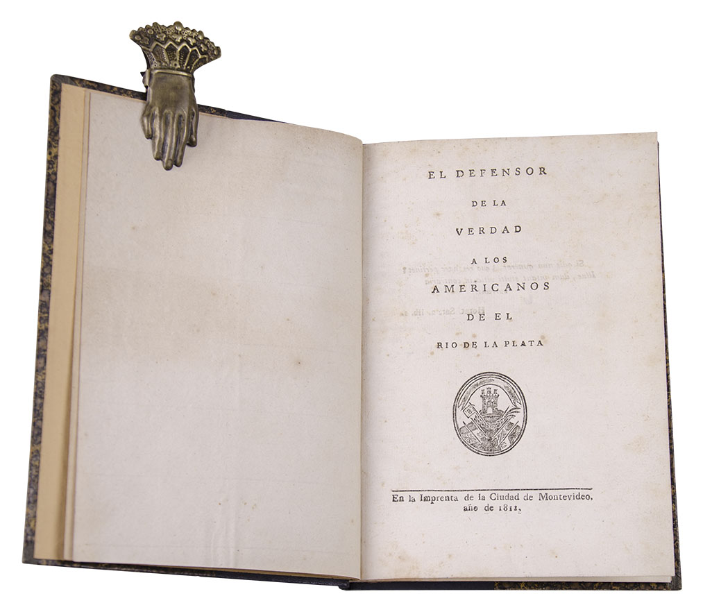
El libro y su comercio en el actual territorio argentino. Siglos XVIXIX
Uruguay en la Bienal de Venecia.

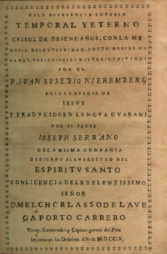
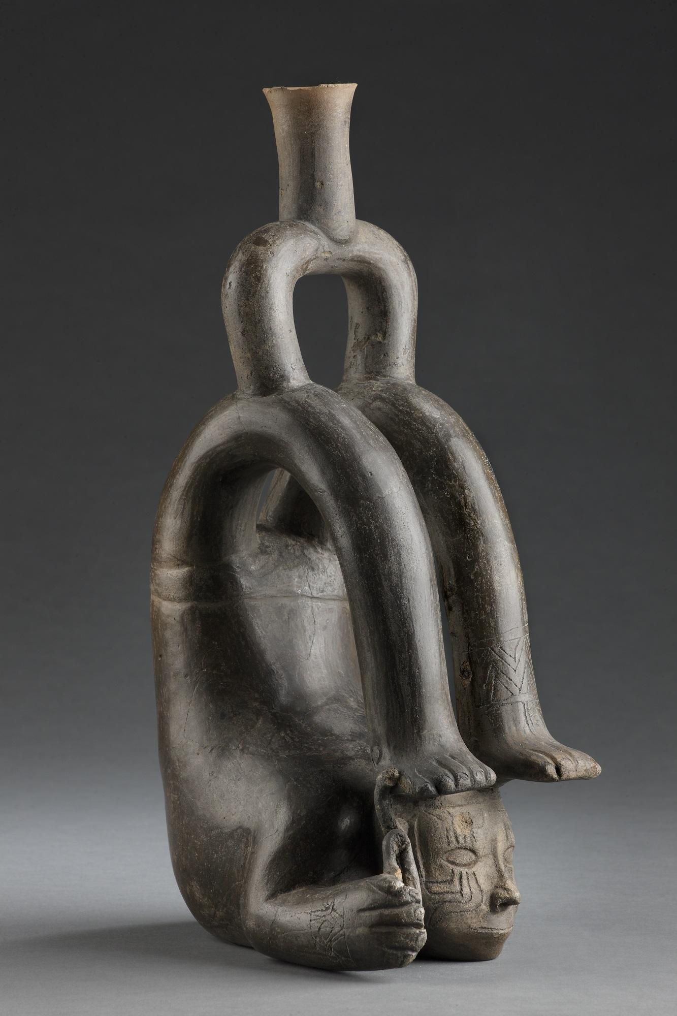
Hecho en Perú.
LA PRESENCIA DEL ESCULTOR FELIPE DE RIVERA EN SALTA, SANTIAGO DEL ESTERO Y CÓRDOBA (ARGENTINA) EN EL SIGLO XVIII.
JUAN DE DIOS MENA, UN IRÓNICO UNIVERSAL.
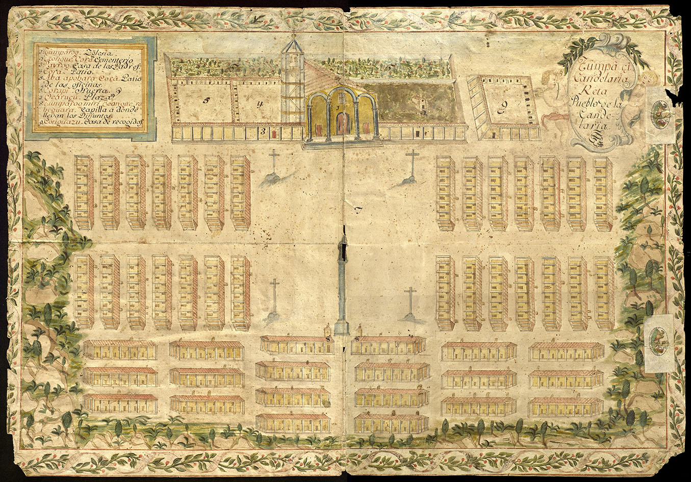
PLANO DEL PUEBLO DE LA CANDELARIA EN LAS MISIONES JESUÍTICAS DE GUARANÍES, CONSERVADO EN LA BIBLIOTECA HISPÁNICA DE LA AECID.
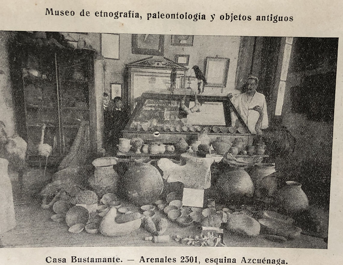
EL MUSEO DE DON PERFECTO PACIENTE BUSTAMANTE, O HAGA PATRIA, TOME HIERBAS ANDINAS Y LUCHE CONTRA LOS MÉDICOS.
NOMBRE Y APELLIDO RUSOS
LOS INÉDITOS DE GUILLERMO FURLONG
EXPANDIENDO EL ARCHIVO MODERNO: LA MIRADA DE FOTÓGRAFAS ALEMANAS EXILIADAS.

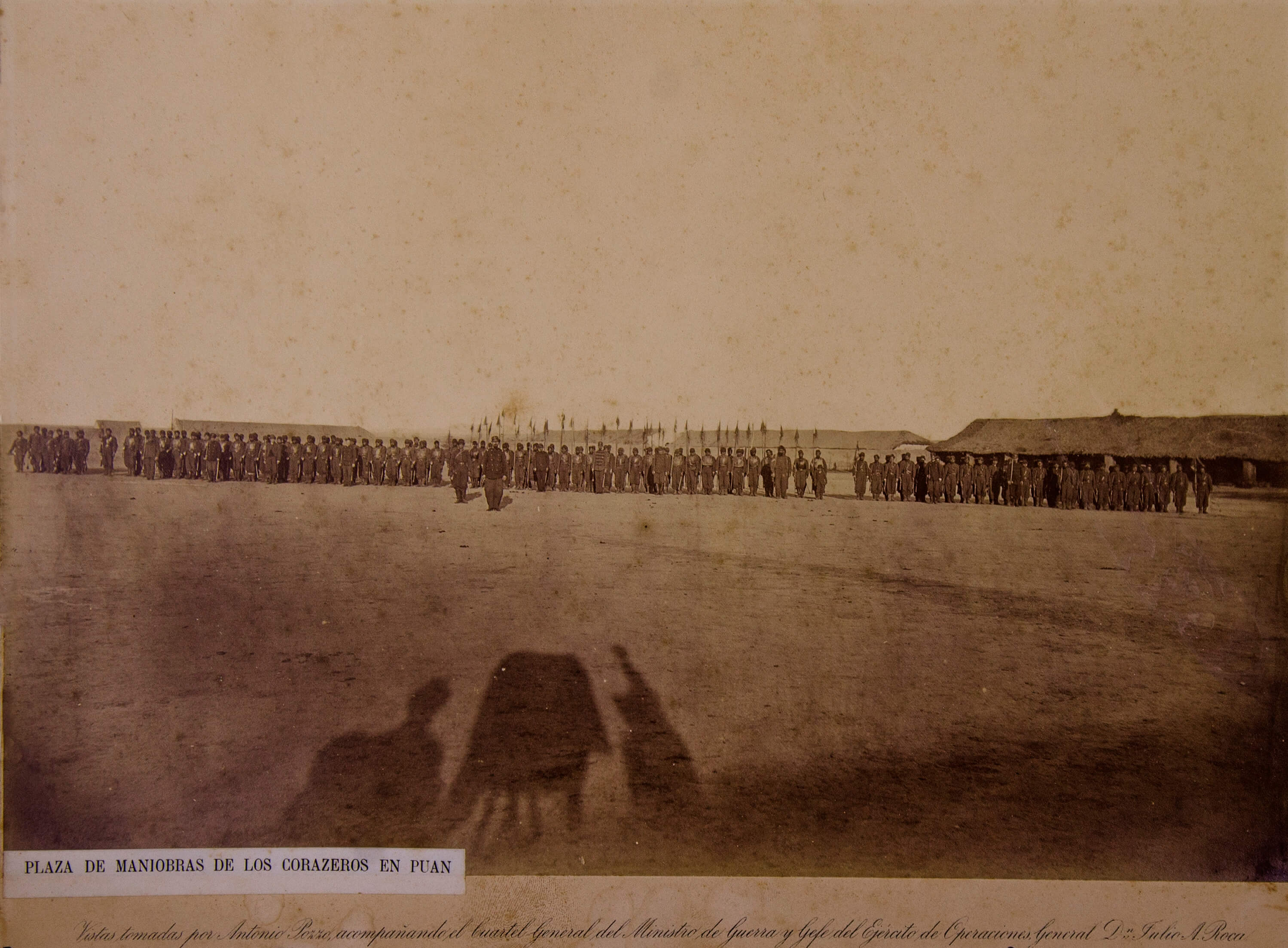
LOS VIAJES AL CHACO AUSTRAL EN 1884 Y 1885. LA CIENCIA EN PROBLEMAS.
GUILLERMINA CABRAL. UNA TRAYECTORIA ATADA A LA MEMORIA.
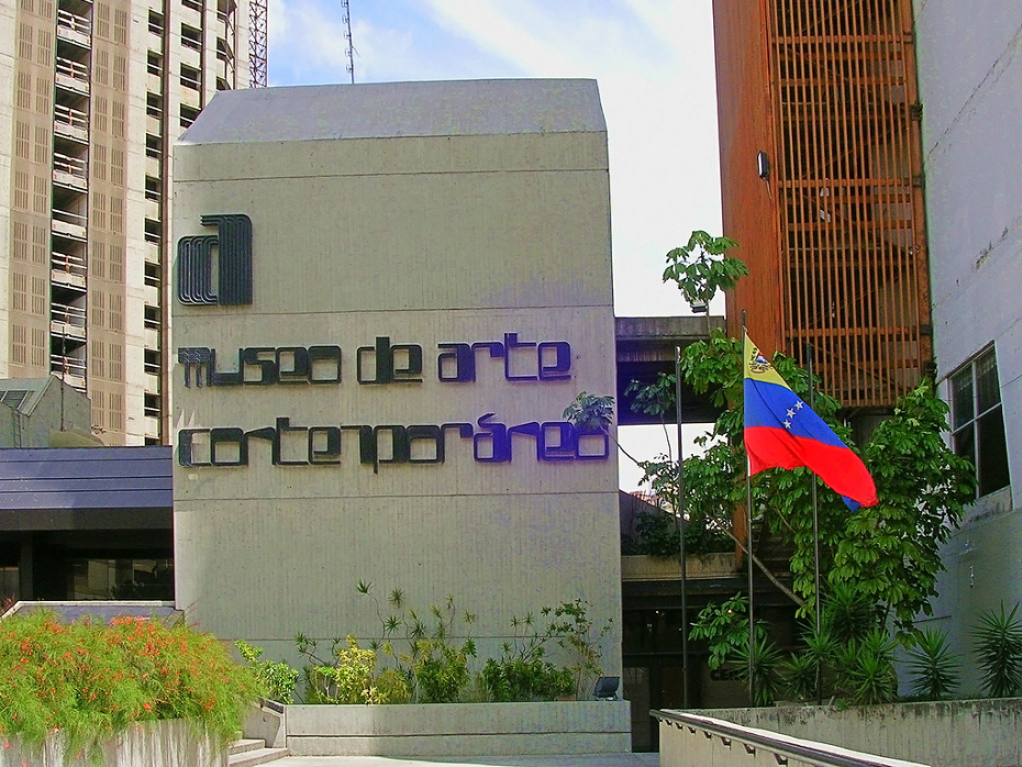
VEINTITRÉS AÑOS DE SOLEDAD O EL CIERRE DEL MUSEO DE ARTE CONTEMPORÁNEO DE CARACAS.

SIRENAS EN EL ZÓCALO.
PERÚ, UN VIAJE EN EL TIEMPO. SORPRENDE EL BRITISH MUSEUM CON UNA EXPOSICIÓN INICIÁTICA.
Vasos que sudan.

LA FOTOGRAFÍA BÉLICA SE INICIABA EN EL MUNDO.
TORNAVIAJE. ARTE IBEROAMERICANO EN ESPAÑA.
Museos de provincia: historias a uno y otro lado del mar.
EZEQUIEL LINARES Y SU GENERAL

UNA COLECCIÓN FOTOGRÁFICA EXCEPCIONAL, RAUCH A PRINCIPIOS DEL SIGLO XX.

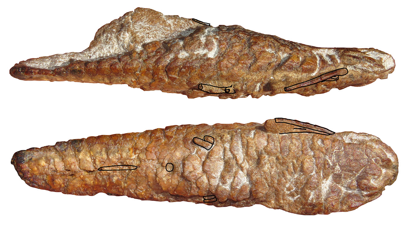
ACONTECIMIENTOS IMPREVISTOS EN LA HISTORIA DE LA CIENCIA. A. PEDERSEN Y LA ARQUEOLOGÍA EN LA ARGENTINA.
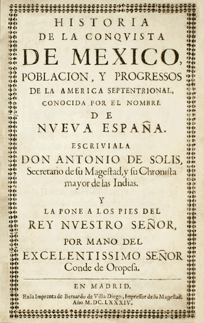
Quinientos años después, México
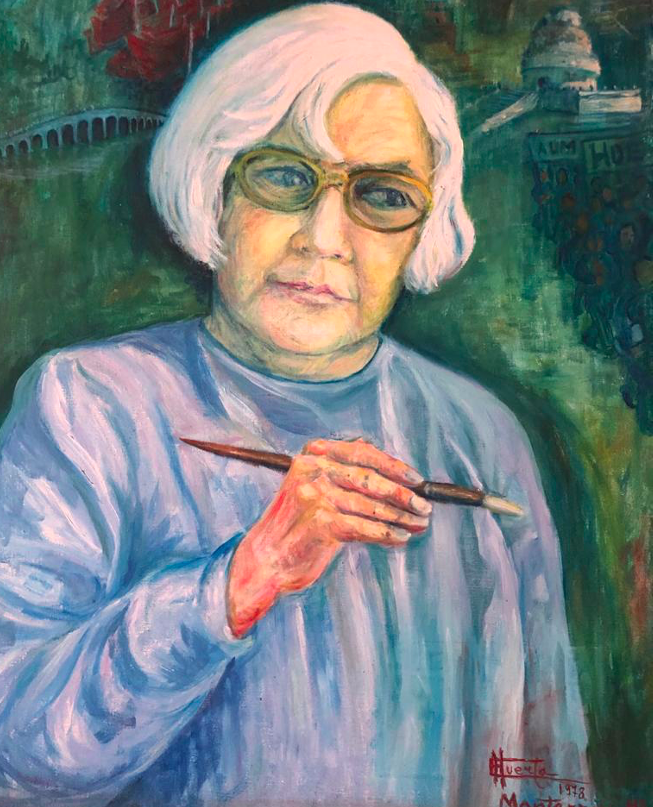
In memoriam de Enrique Fuentes Castilla (1)
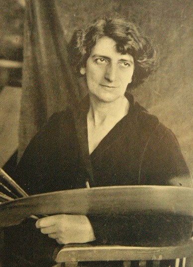
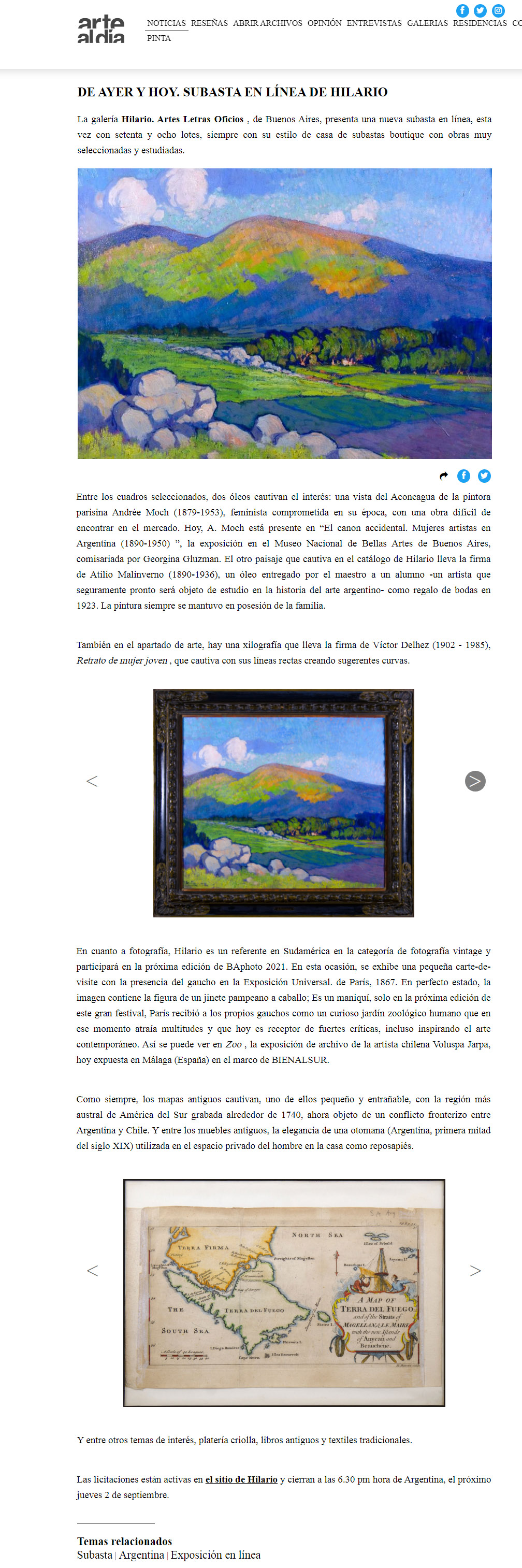
Una moderna artista francesa en la Argentina: Andrée Moch (1879-1953)
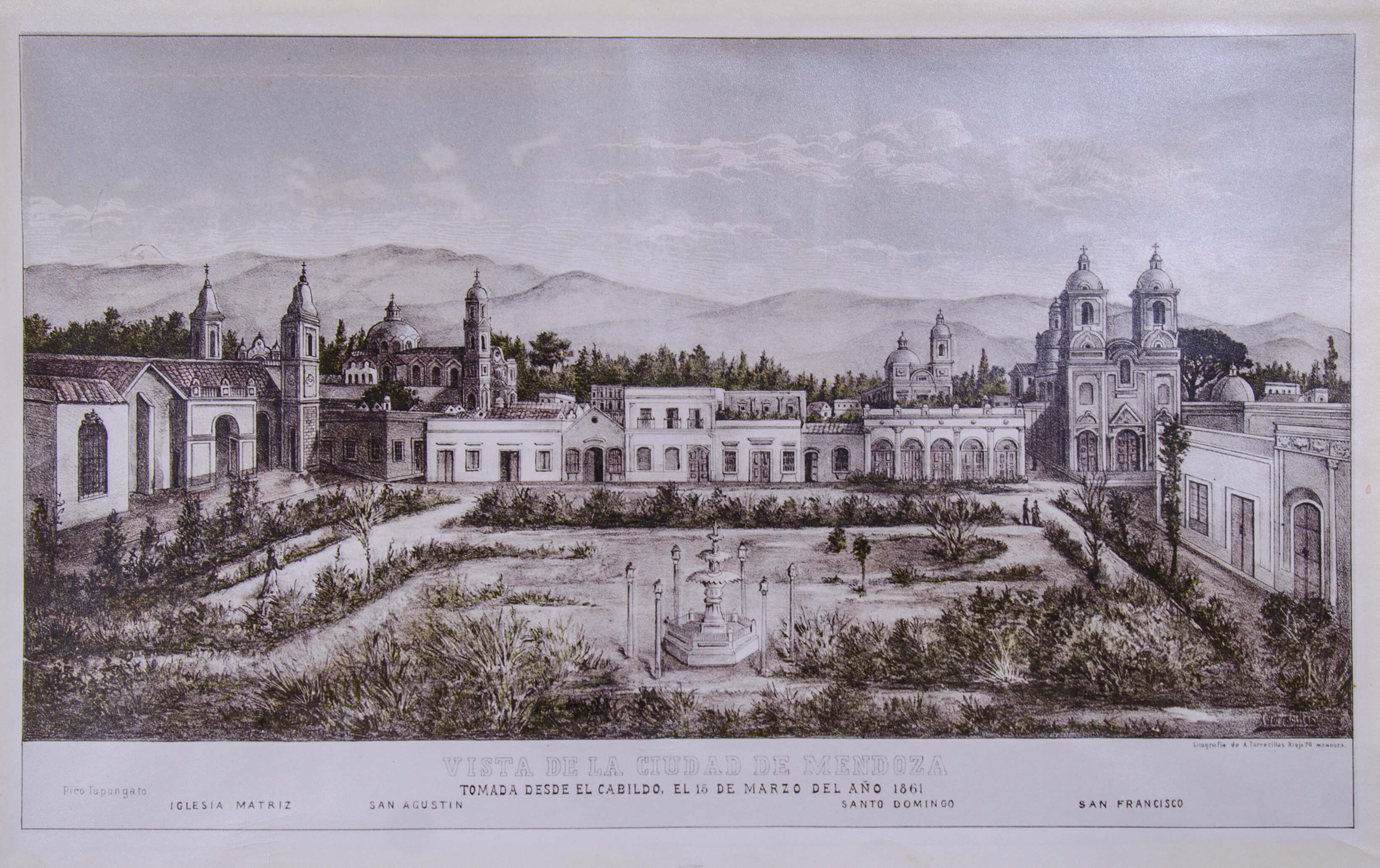
La iconografía mendocina y un escurridizo litógrafo: A. Torrecillas
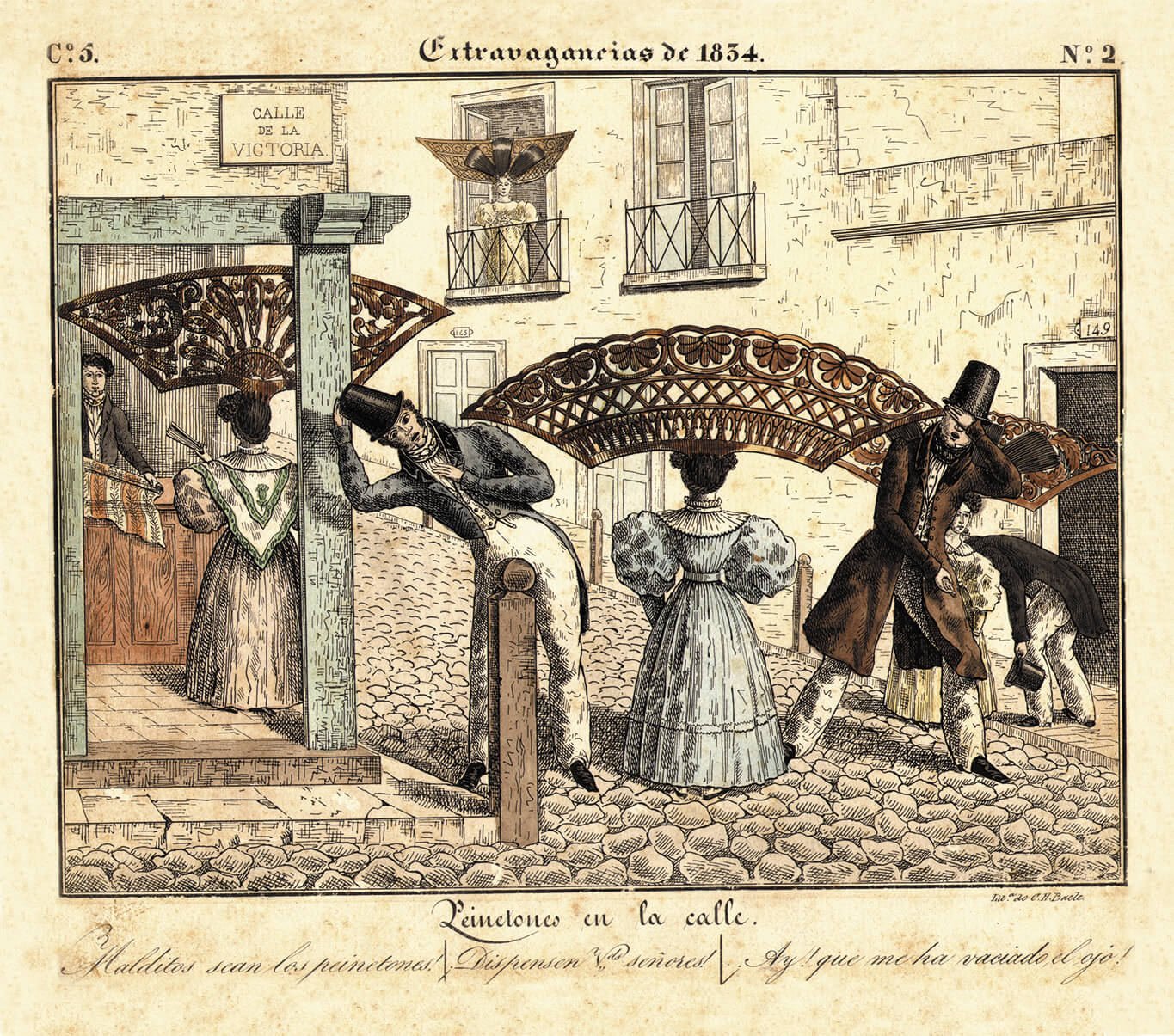
El peinetón

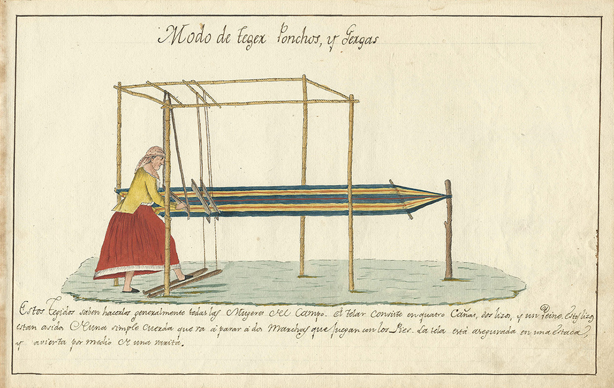
EL TELAR DE ESTACAS Y SU ARRAIGO EN SUELO AMERICANO
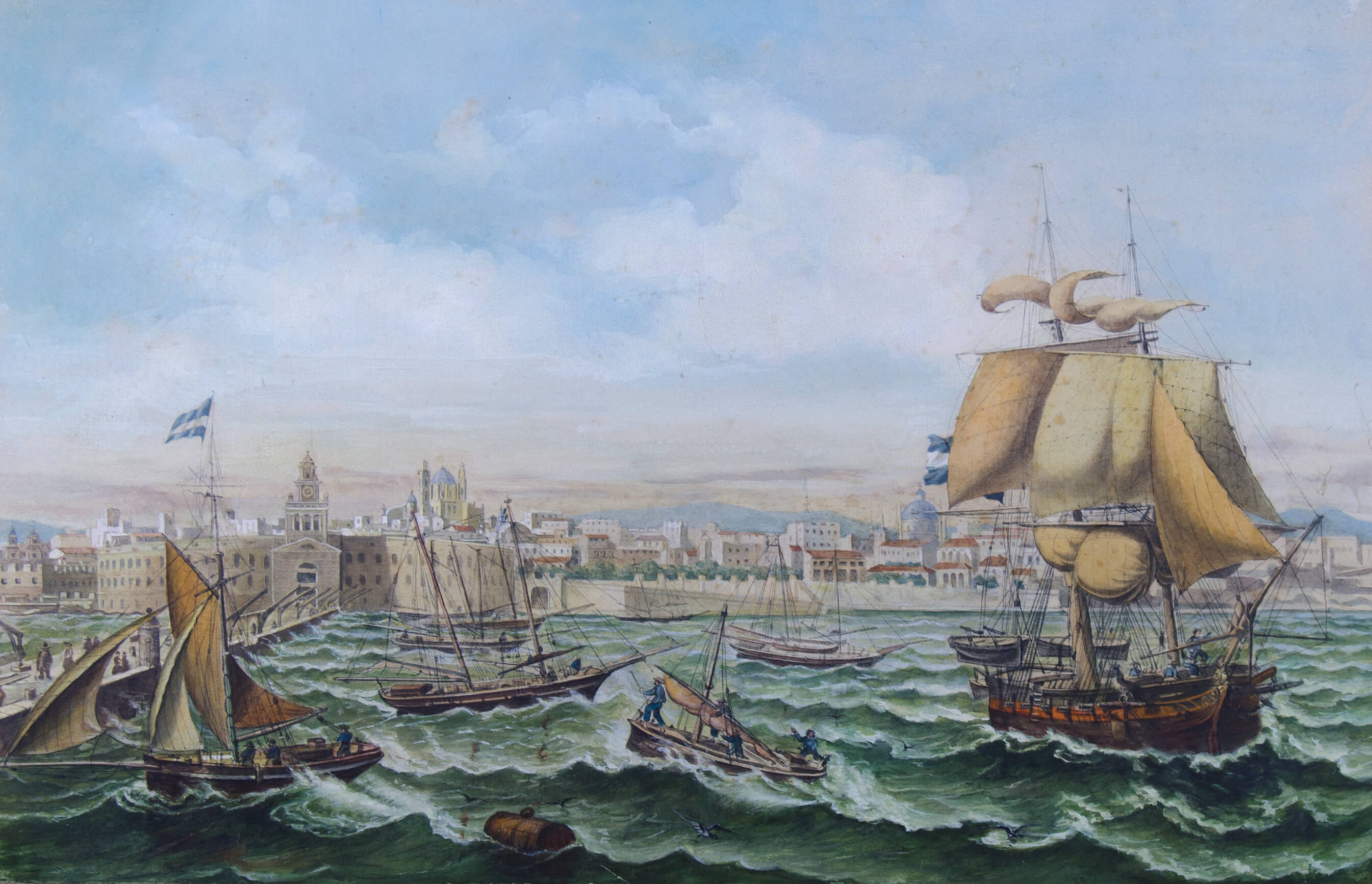
Louis Le Breton y la vista de Buenos Aires desde el muelle de la Aduana Nueva.
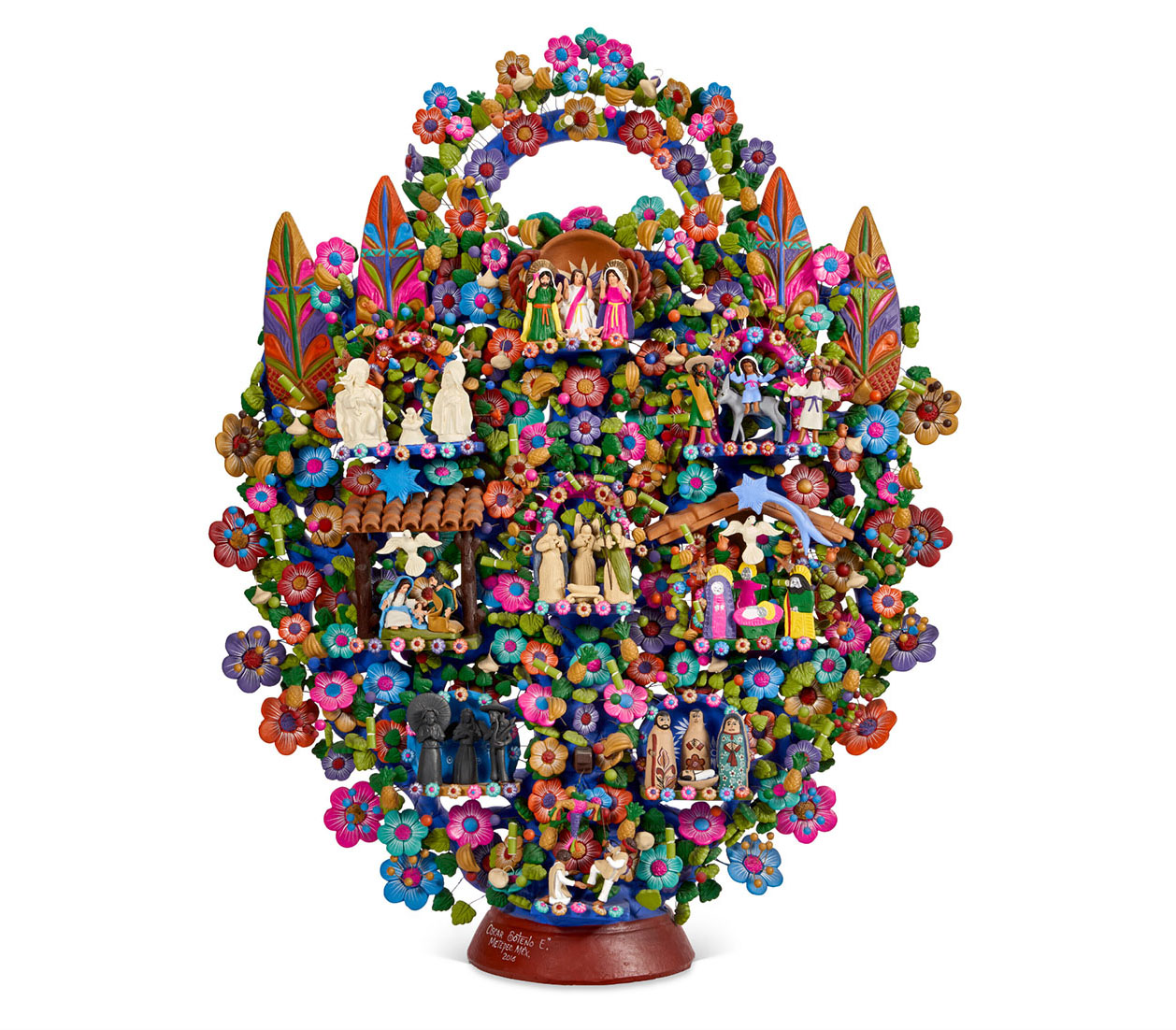
La creación de la imaginería popular y sus particularidades regionales.
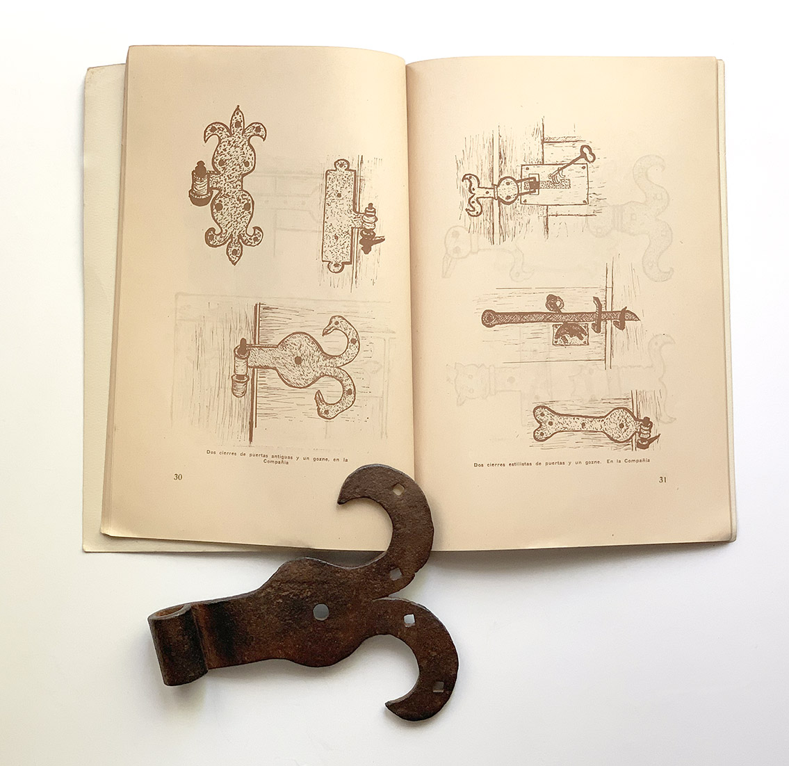
INVENTARIOS QUE CUENTAN HISTORIAS: RAZÓN DE LA LAYA DE FERRATERÍA QUE SE GASTA EN LA PROVINCIA DE BUENOS AIRES
ARTE POPULAR, UN COLECCIONISMO CAUTIVANTE
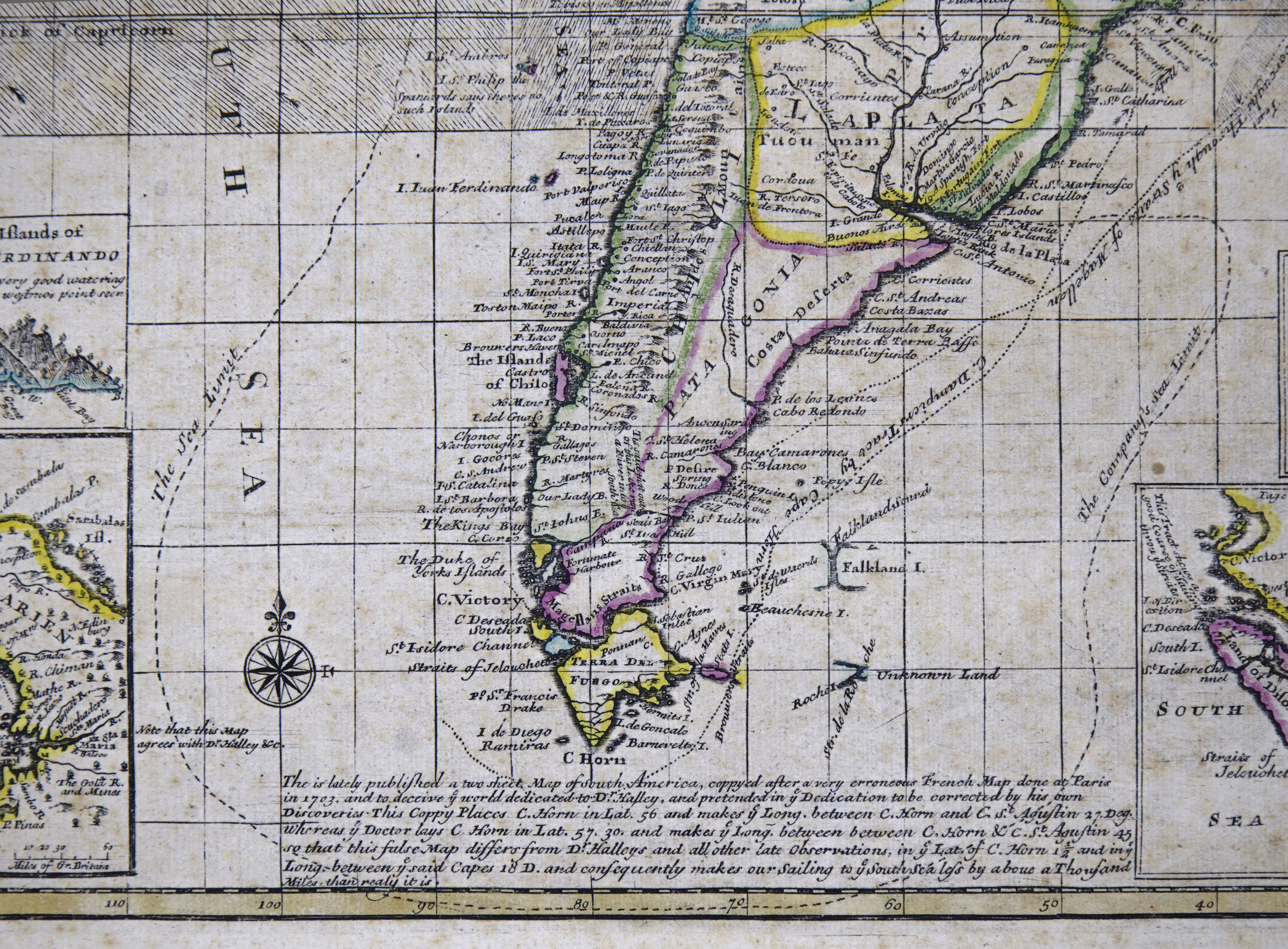
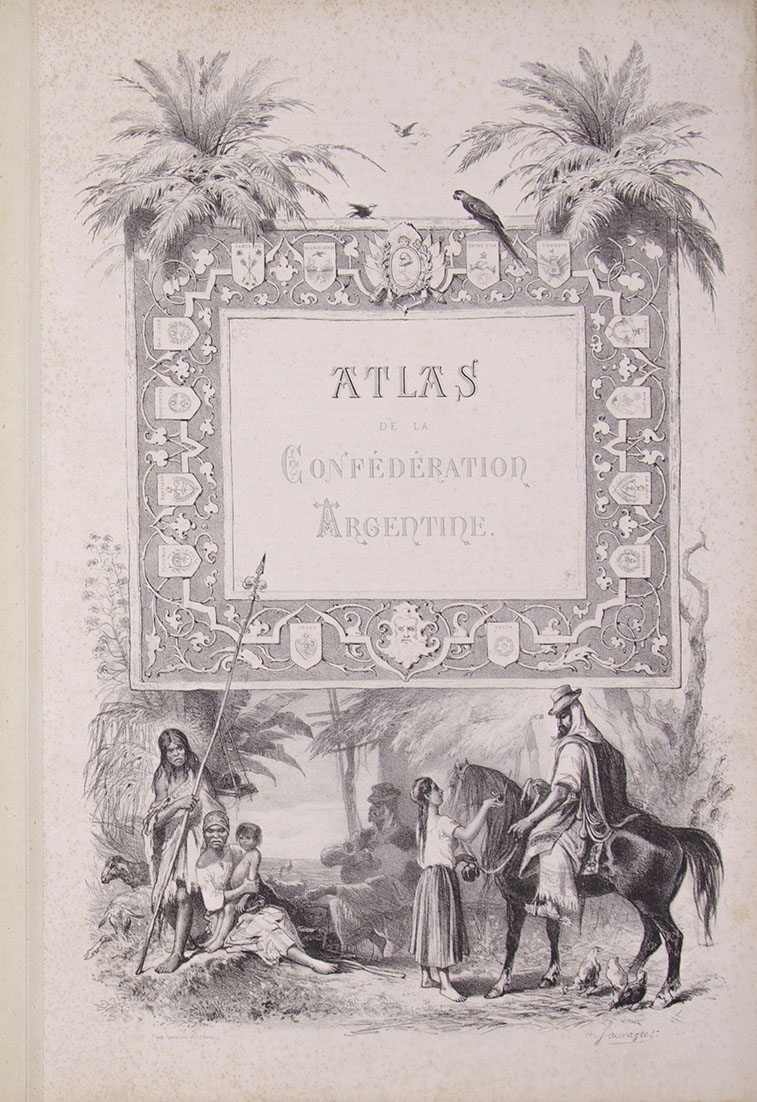
ARGENTINA: LA CARTOGRAFÍA DE LOS TERRITORIOS NACIONALES (1885-1930)
JEAN-LEÓN PALLIÈRE
COLECCIONAR FOTOGRAFÍAS, UNA RUTA HACIA EL PLACER
CONSEJOS Y SUGERENCIAS
En esta sección les brindamos información diversa que resultará de utilidad para evolucionar en sus colecciones. Anécdotas y otras experiencias les facilitarán los caminos de búsqueda y permitirán una mejor clasificación de sus conjuntos.
Encontrarán libros sugeridos para su lectura y una selección de Bibliotecas de consulta, reunidas por temas a coleccionar. En las páginas de los títulos indicados tendrán ustedes una fuente de información de enorme valor.
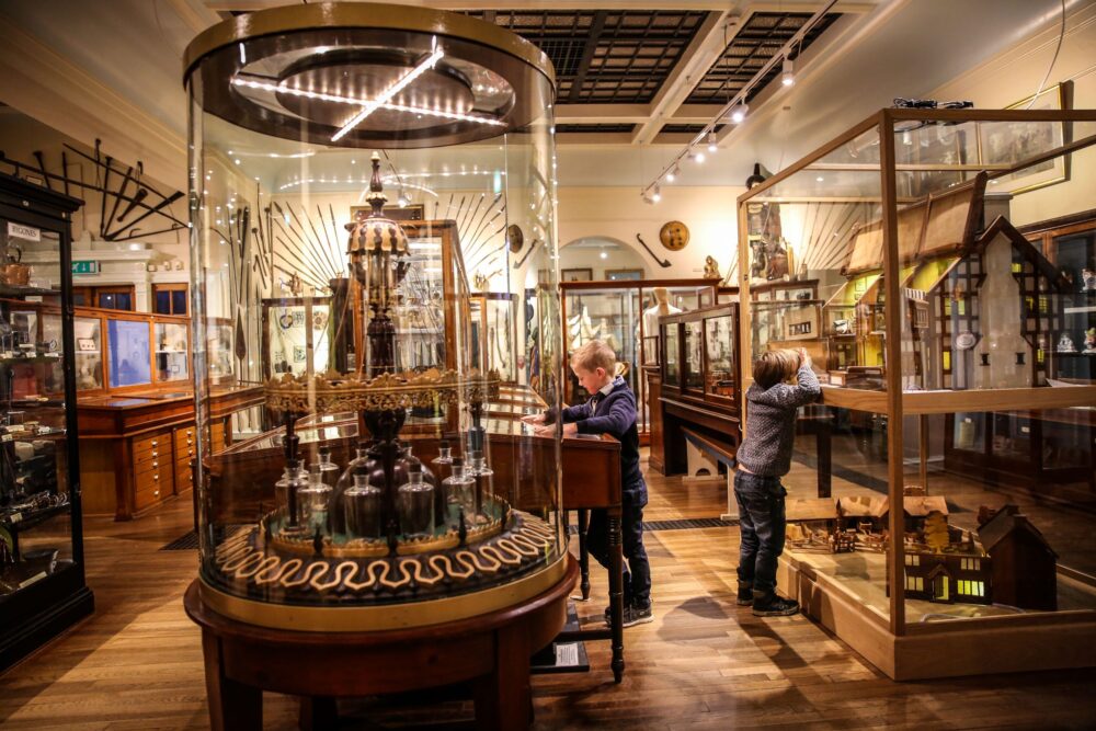
PASEOS CULTURALES
Esta pandemia nos obliga a continuar en alerta y según el país donde se encuentre o visite, advertirá que las restricciones prosiguen. Por ello proseguimos con la iniciativa de invitarlo a realizar paseos virtuales por distintos espacios culturales, y si es un privilegiado que puede disfrutar de un descanso en su lugar de residencia o fuera, le sugerimos diversos destinos, siempre aunando cultura y ocio.
NOTICIAS Y MÁS
Artesanías para salvar el mundo
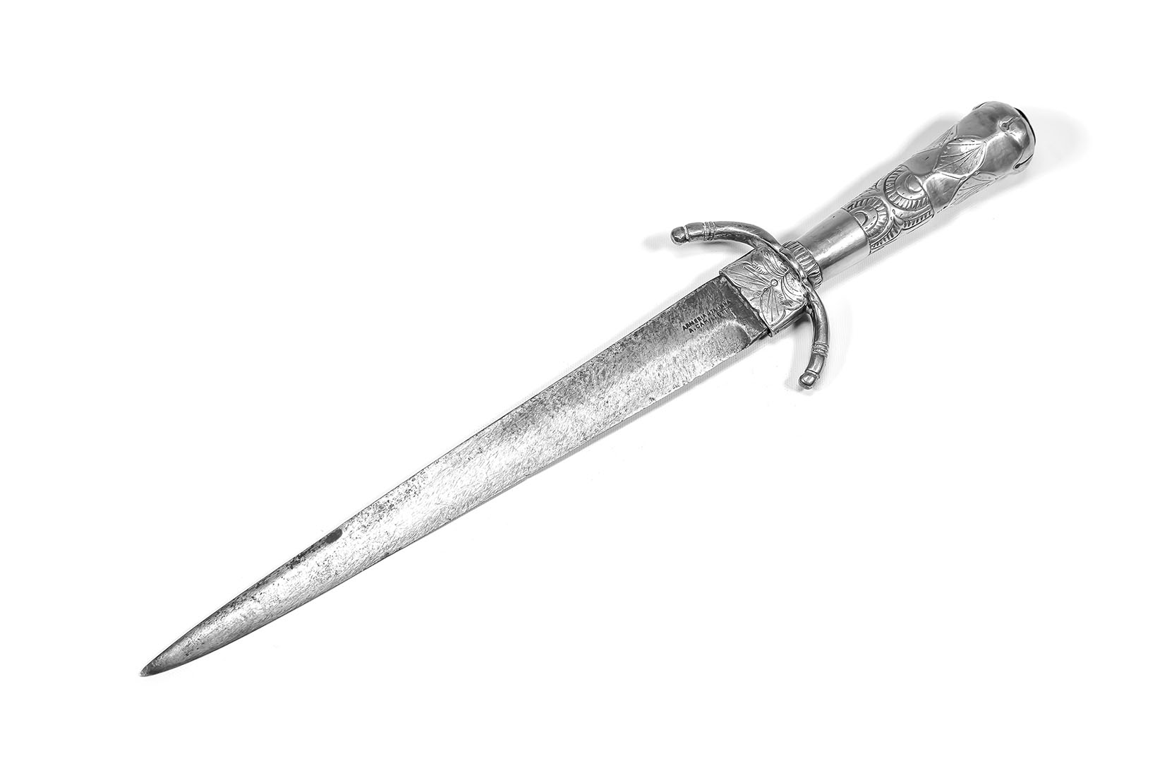
La armería italiana de Augusto Camilletti en la ciudad de Córdoba
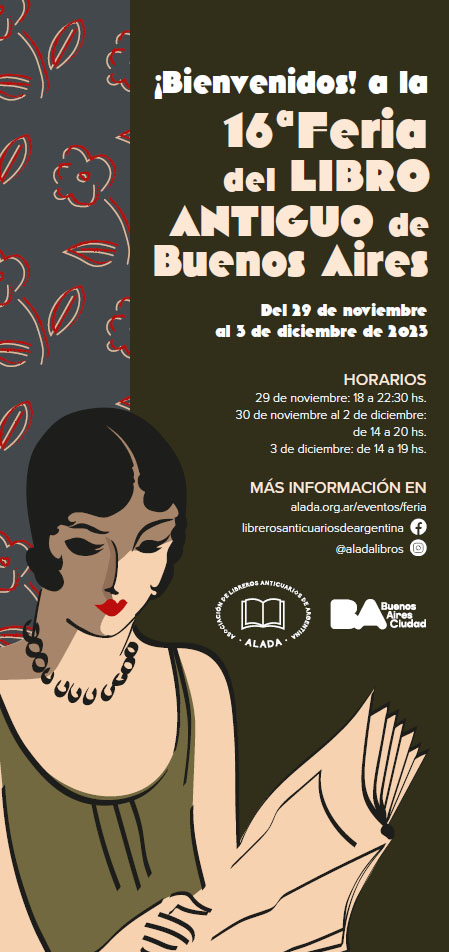
Llega la 16° Feria del Libro Antiguo de Buenos Aires
Un remate rioplatense que ha sido noticia

El adiós a uno de los grandes del Teatro de nuestros tiempos, Jorge Lavelli
Arte Popular Mexicano en la venta de Arte Latinoamericano Online de Christie's Nueva York
Los presentes del tiempo
Un nuevo hito en el arte contemporáneo, la Colección Bruzzone y un martillo que hizo historia
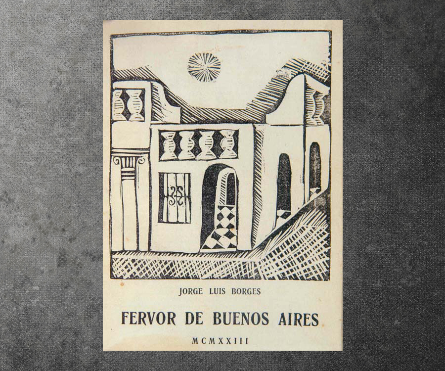
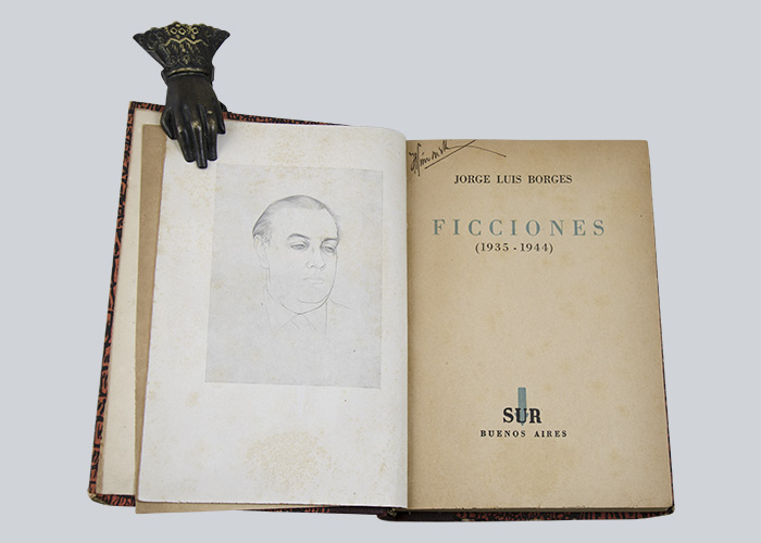
La Asociación de Libreros Anticuarios de Argentina (ALADA) homenajea a Jorge Luis Borges con Fervor
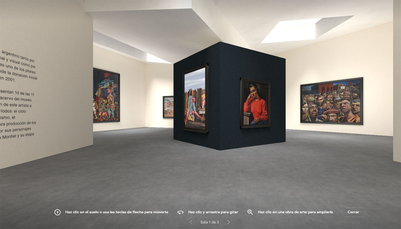
El MALBA llegó a la plataforma Google Arts & Culture
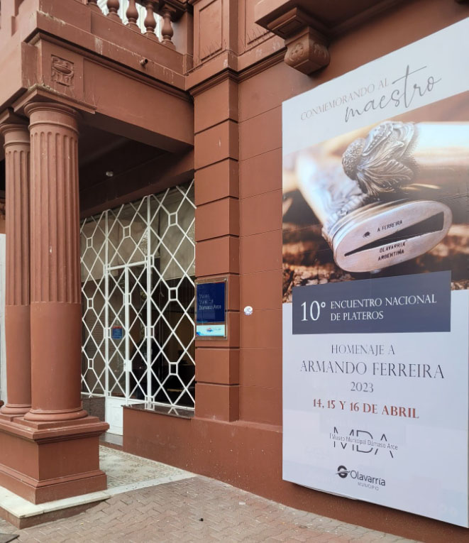
10° Encuentro Nacional de Plateros, en homenaje al Maestro Orfebre Armando Ferreira.
Finitud infinita

Un nuevo récord sale a la luz en Sussex
Exposiciones de Le Parc, Kuitca y Lukas. Un broche de oro para el primer año del MACA
La certeza del viento
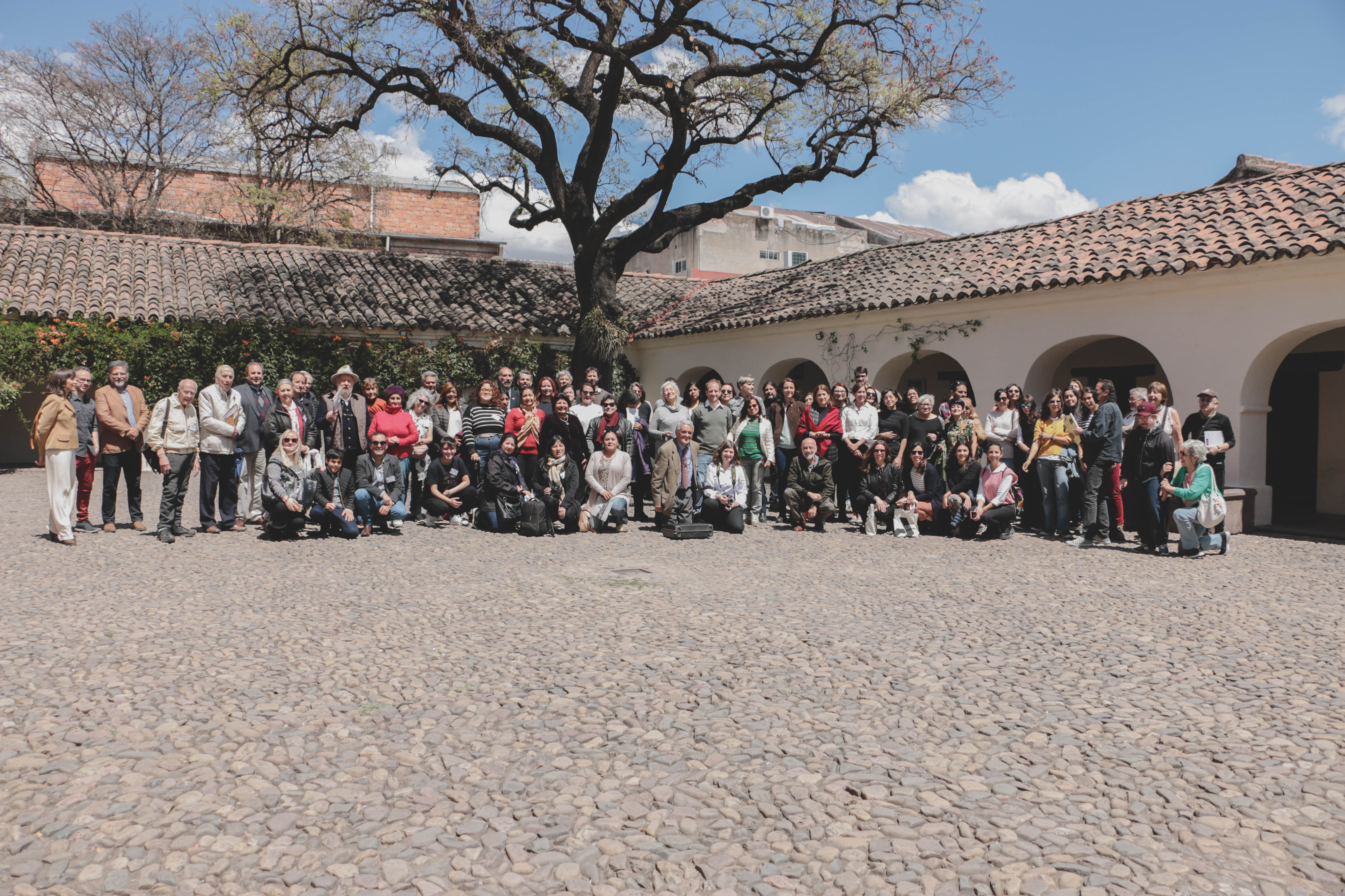
1° Congreso de Historia de la Fotografía en el Noroeste de Argentina.
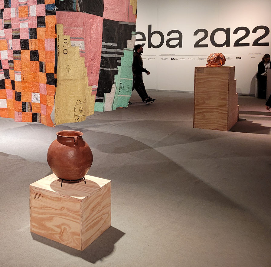
Arteba 2022 y en los límites del arte, las artesanías
Cuatro ojos para un tercero.
De la Nubia a La Plata. El improbable viaje de Abraham Rosenvasser.
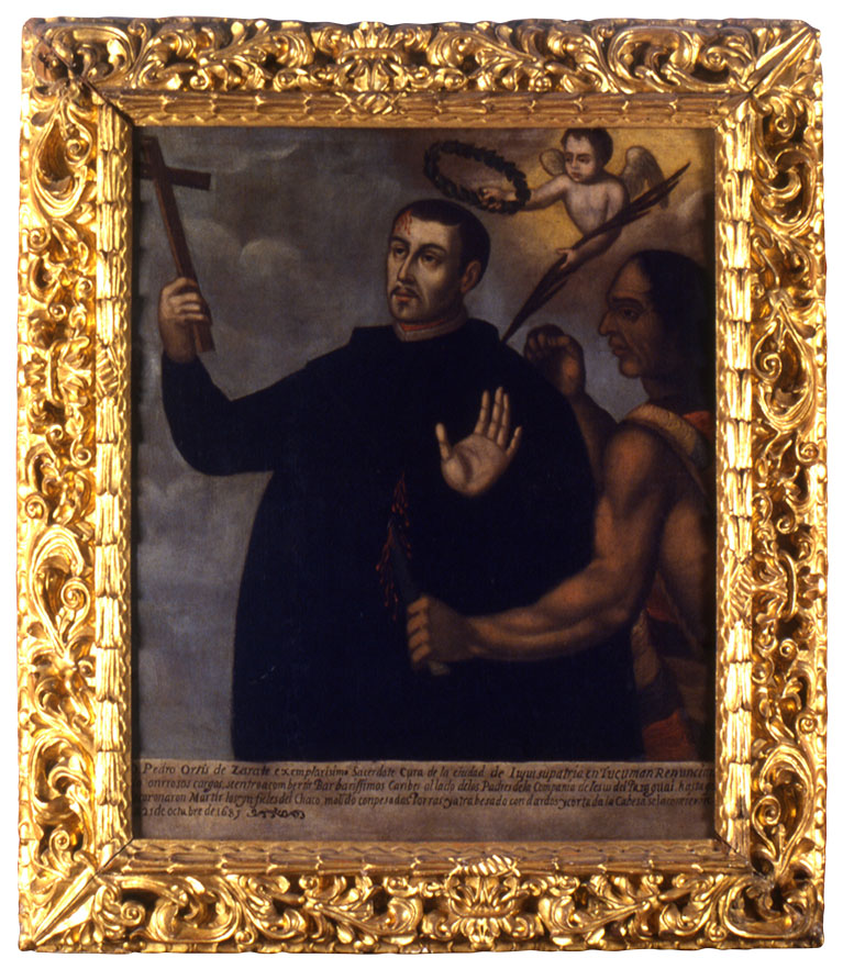
El cuadro del jujeño Pedro Ortiz de Zárate, el nuevo Beato de la iglesia católica
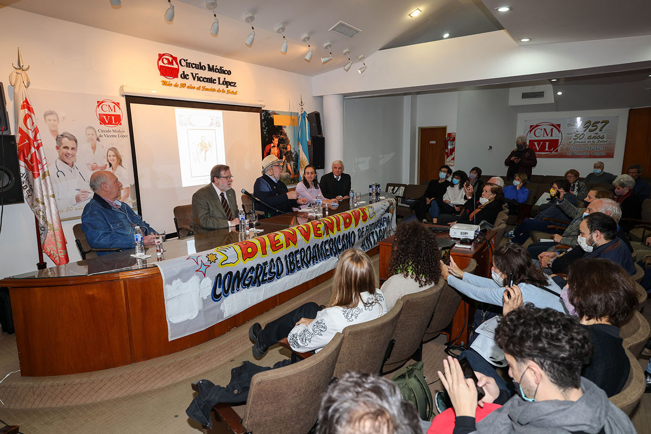
Primer Congreso de Historia de la Fotografía en Argentina. Reflexiones sobre una nueva disciplina histórica a treinta años de distancia.
Alejandro Eduardo Fiadone, seguiremos conversando, no lo dude.
El arte paraguayo de luto por Marcos Ortiz, artista indígena.
¿Cuánto vale el arte?

MÁS DE UN MILLÓN DE DÓLARES POR EL VACÍO. LA ZONA DE SENSIBILIDAD PICTÓRICA INMATERIAL DE YVES KLEIN.
ARTE EN TIEMPOS DE GUERRA. CUANDO SE CRUZAN LO MEJOR Y LO PEOR.
LA HISTORIA CONTINÚA, SE CELEBRÓ LA 37° FIESTA NACIONAL DE LA ARTESANÍA.
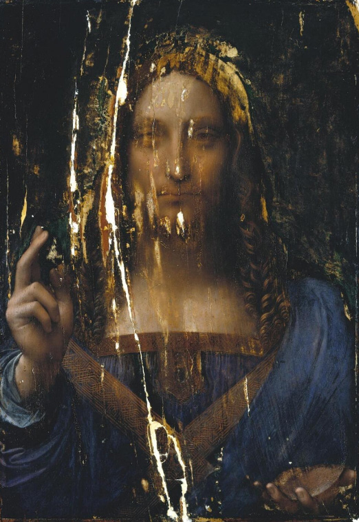
¿EL ÚLTIMO LEONARDO?
LOS SUEÑOS DE LEONORA. ARTISTAS ARGENTINOS EN LA BIENAL DE VENECIA.
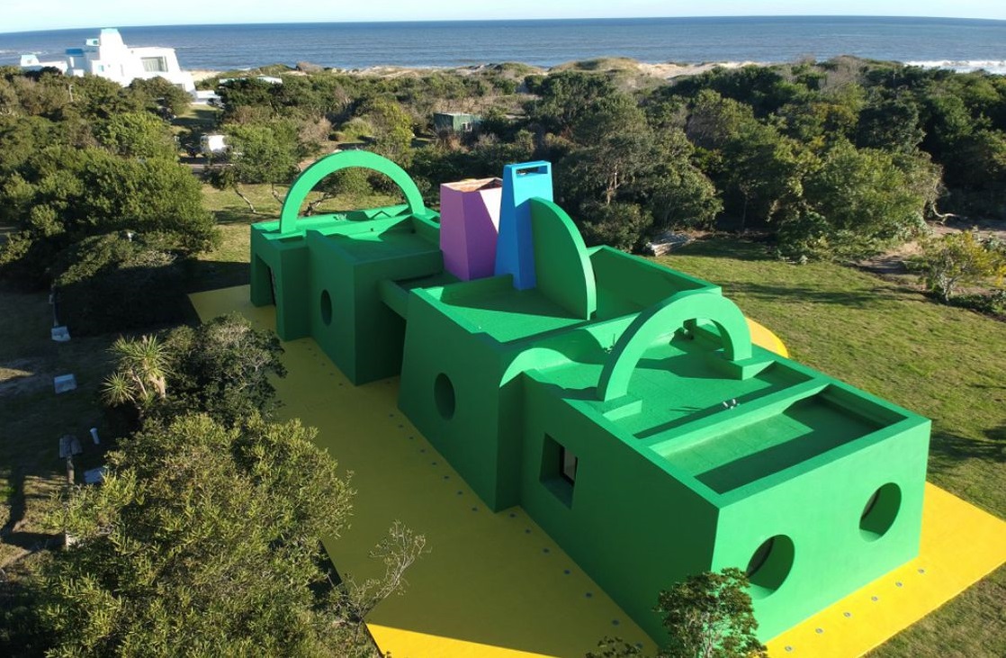
NUEVOS AIRES PARA EL ARTE CONTEMPORÁNEO EN EL RÍO DE LA PLATA.
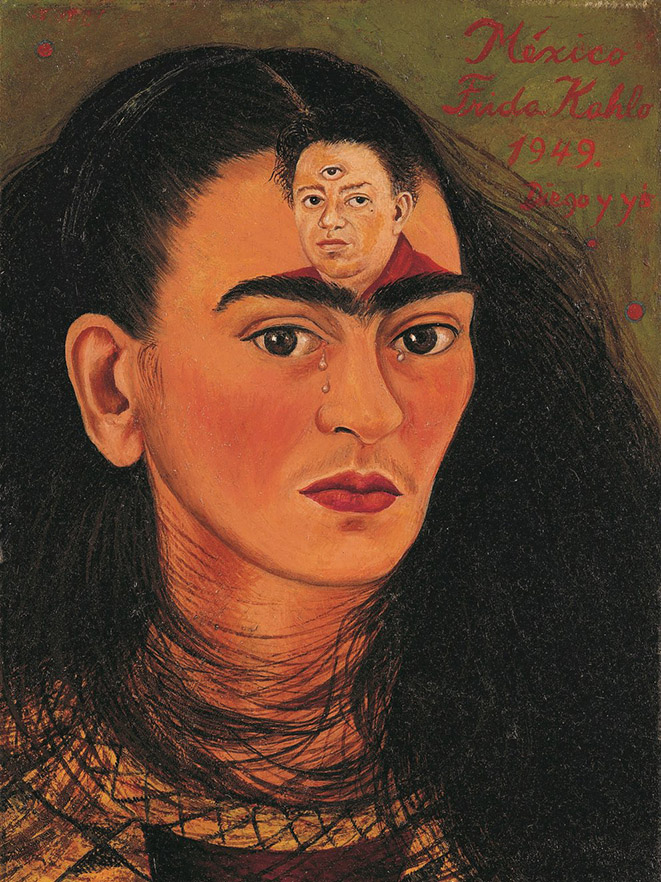
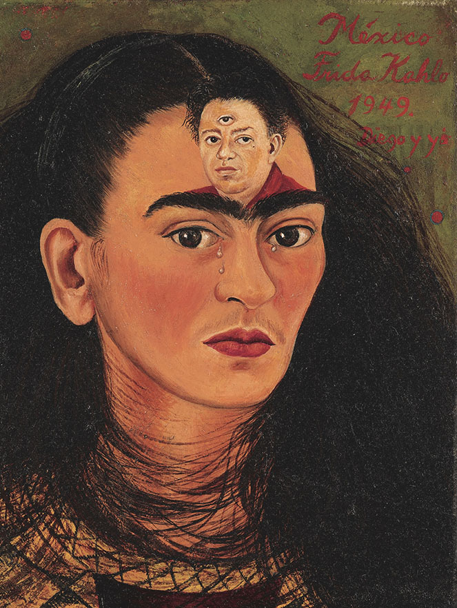
Diego y yo.
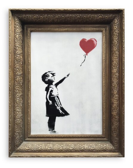
BANSKY: LA FICCIÓN DEL ESTRAGO.
PATRIMONIO FOTOGRÁFICO LATINOAMERICANO.

SE VIENE arteba

Sumar para Crecer. El CEDODAL mira al futuro
LA HISTORIA DE LA FOTOGRAFÍA EN LA PROVINCIA DE CÓRDOBA, ARGENTINA.
UN NUEVO VERMEER EN PLENO SIGLO XXI.

14° Feria del Libro Antiguo de Buenos Aires
BIENALSUR 2021
EL CRIPTOARTE. ¿LLEGÓ PARA QUEDARSE?
El Louvre tiene finalmente un nombre de mujer.
ANDREA ALKALAY, SU PROYECCIÓN INTERNACIONAL.
OBRAS EN VENTA DIRECTA
Lo invitamos a recorrer nuestras existencias. Disfrutará de un rico gabinete de curiosidades ordenado por las áreas temáticas. Cada artículo vendido se entrega con su Estudio de Obra.

LIBROS PARA EL VERANO

SUBASTA MONTEVIDEO

ARTE

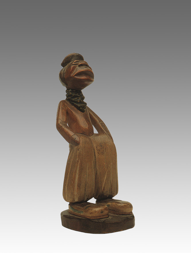
Arte Étnico

Arte Popular

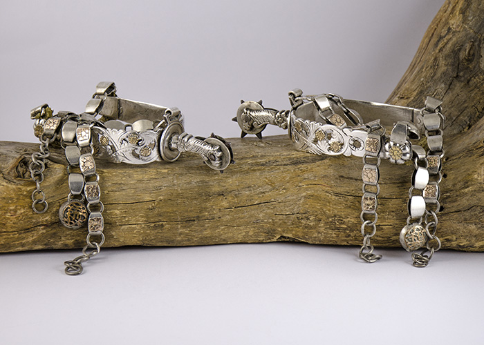
COLECCIÓN DE ESTRIBOS

DECORACIÓN

ENCUADERNACIONES

FOTOGRAFÍA

HIERRO Y OTROS METALES

LIBROS CONTEMPORÁNEOS

LIBROS ANTIGUOS

MAPAS & PLANOS

MUEBLES

OBJETOS HISTÓRICOS / MILITARIA

OBRA GRÁFICA

PLATERÍA

Soguería & asta

TEXTILES
¿Le interesa vender algunas obras?
Envíenos un correo electrónico indicando brevemente
qué obras piensa poner en venta, y le responderemos. Haga click aquí
OBRAS DE LA SEMANA
Forma este escenario una selección de obras especiales. Objetos con alma, piezas únicas que seducen y cuentan sus historias. Lo invitamos a disfrutar.
LA PRENSA DICE
Con el objetivo de mantenerle informado sobre las principales noticias relacionadas con Hilario le ofrecemos un resumen de la prensa. Además podrá encontrar información adicional de varios temas de nuestro interés.
La Feria del Libro Antiguo llega con joyas y rarezas literarias, y un homenaje a Borges
Feria del Libro Antiguo: un paseo con joyas, rarezas literarias y un homenaje a Borges
Con manuscritos borgeanos en venta, comienza la Feria del Libro Antiguo en el Palacio La Prensa
Feria del Libro Antiguo de Buenos Aires: comienza la 16ª edición del encuentro que ofrece tesoros y rarezas
Subastarán en Uruguay siete relatos inéditos de Julio Cortázar que encontraron en una caja

Sept inédits de Julio Cortazar retrouvés lors dune succession et mis aux enchères en Uruguay
Descubren siete relatos inéditos de Julio Cortázar
Subastarán en Uruguay textos originales de Cortázar, algunos icónicos y otros inéditos
Mecanoscrito original de obra icónica de Cortázar será subastado en Uruguay
Pinta BAphoto vuelve a La Rural con una edición ampliada
Mucho público y cautela para comprar en Pinta BAphoto
Pinta BAphoto y muchas formas de mirar: la fotografía se celebra como potencia artística
Pinta BAphoto, la muestra de fotografía más importante del año
Los fotógrafos celebraron su día en la inauguración de Pinta BAphoto
Historias narradas en imágenes, entre las obras imperdibles de Pinta BAphoto
Documentos históricos: hallazgo y ...
BAphoto celebró el arte y el poder verlo cara a cara
En formato blend. Con un programa virtual ...
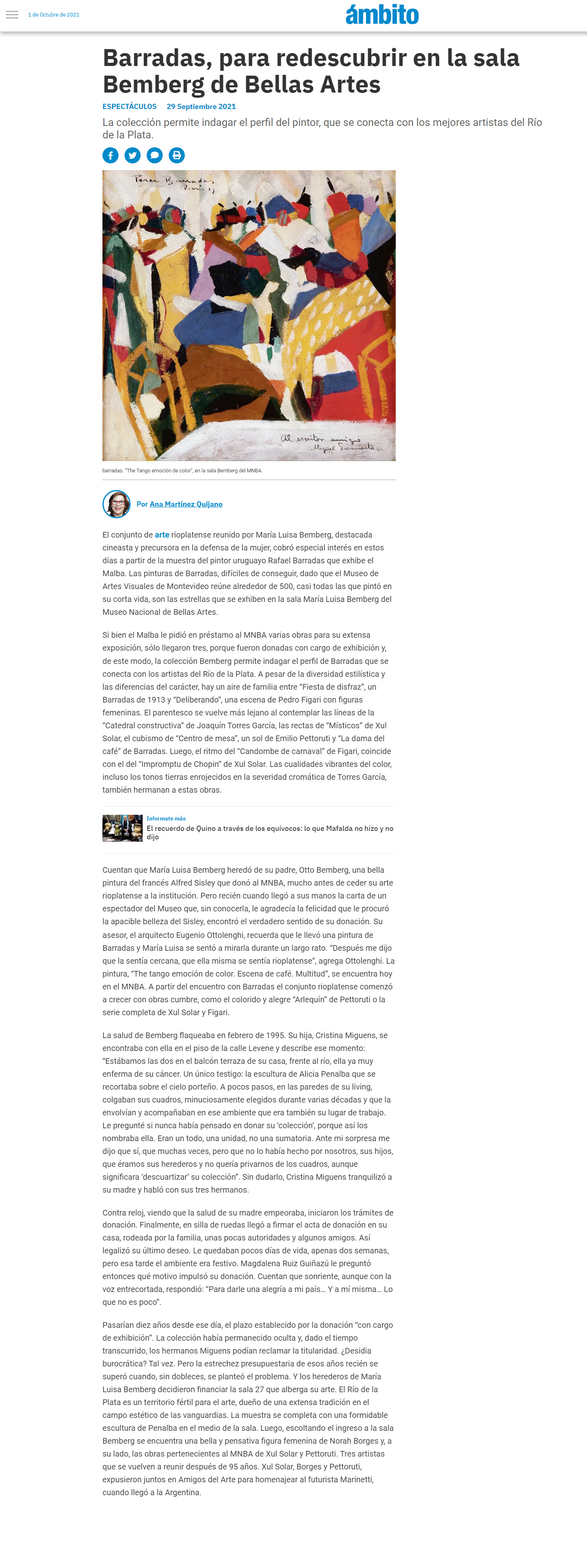
Barradas, para redescubrir en la sala Bemberg...
DE AYER Y HOY.SUBASTA EN LÍNEA DE HILARIO, ARTES LETRAS OFICIOS.
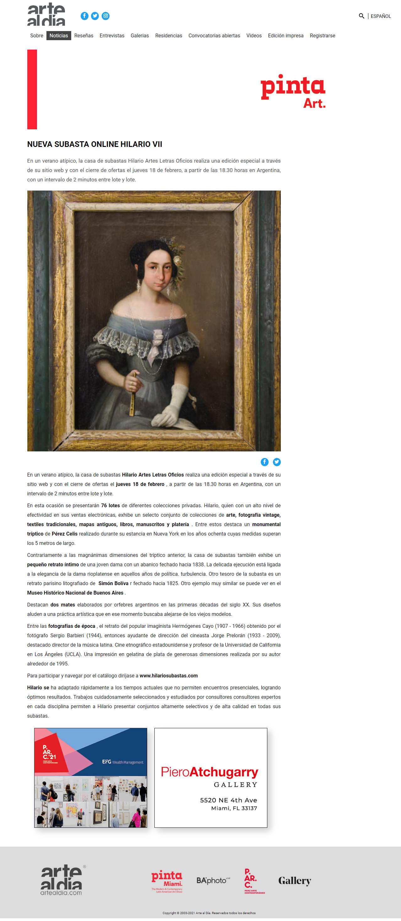
NUEVA SUBASTA HILARIO ONLINE VII - Artes Letras Oficios
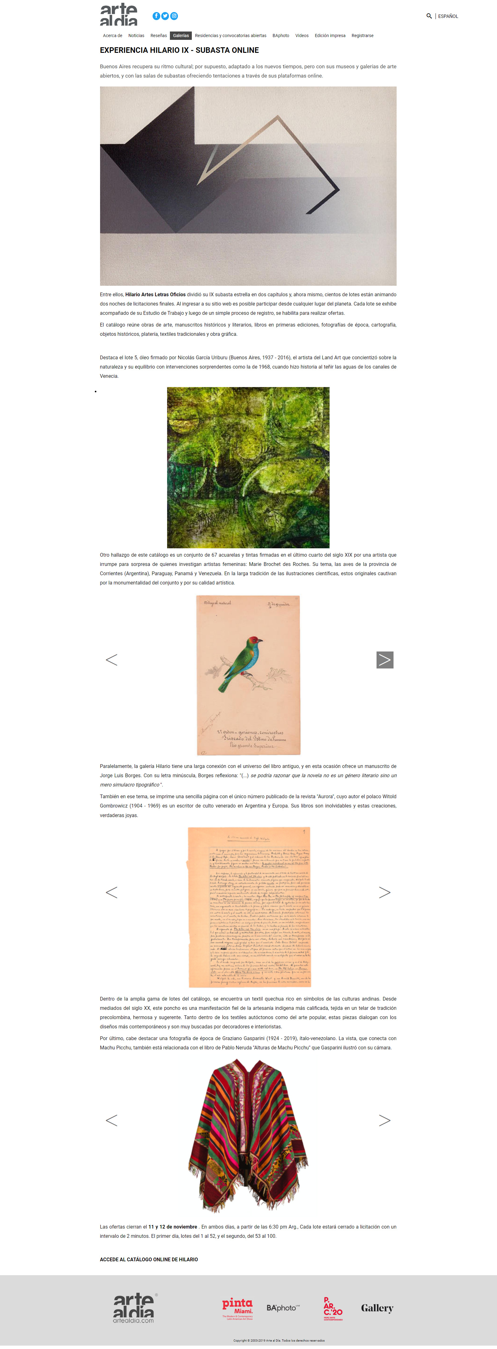
Subasta Experiencia Hilario IX - Artes Letras Oficios - Cap 2
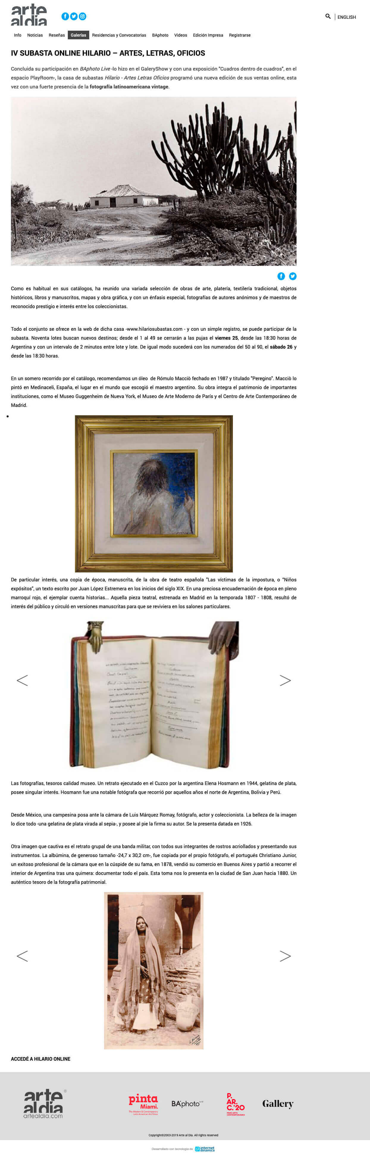
IV SUBASTA ONLINE HILARIO ARTES, LETRAS, OFICIOS
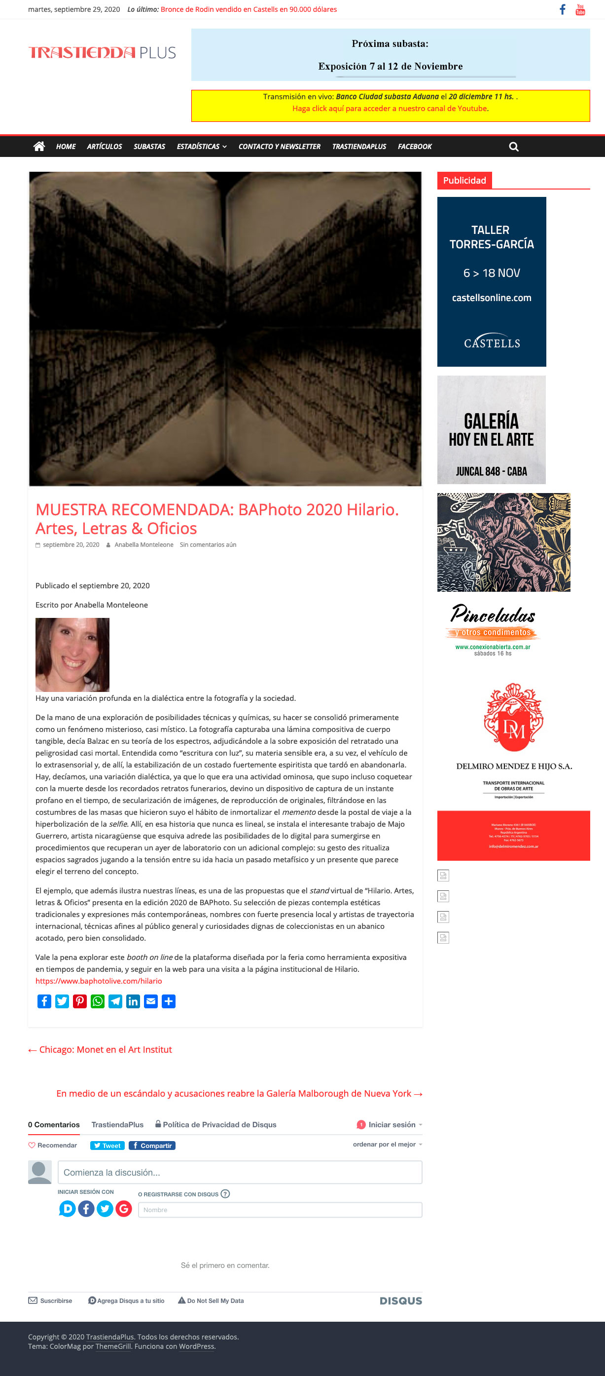
MUESTRA RECOMENDADA: BAPhoto 2020 Hilario. Artes, Letras & Oficios
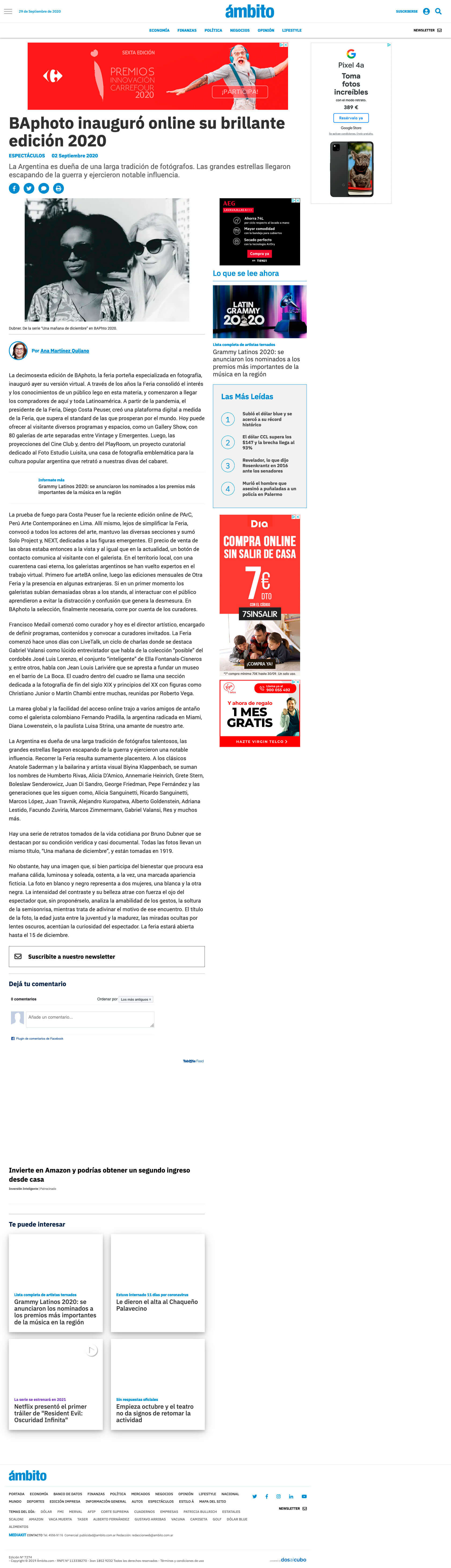
BAphoto inauguró online su brillante edición 2020
Los tesoros y las rarezas nacionales que se exhiben en...
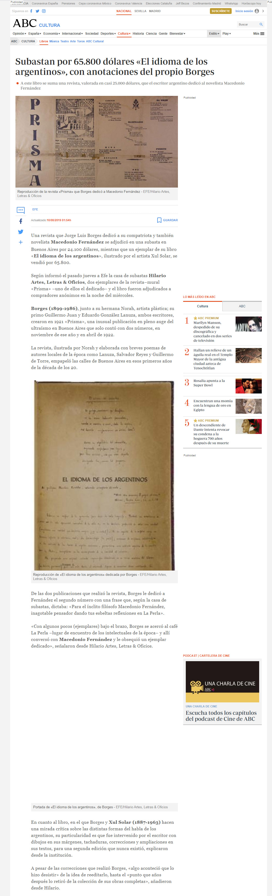
Subastan por 65.800 dólares «El idioma de los argentinos»,...
Suscríbase a nuestro newsletter para estar actualizado.
Ver nuestras Revistas Digitales